See plot of the actual path Limmershin travels, click HERE!
| 2012 LABRADOR TRIP LOG Permanent Crew: Sean Callahan, George Curtis, Bob Sopka. Visiting Crew: Richard Morse, Peter Morse, Justin Harper, David Jenkins, Patrick Callahan, Jason Wilson. |
|||||||||||
| To view this log in chronological order, CLICK HERE. | |||||||||||
| REPORTING DATE | LOCATION
|
COMMENTS | PICTURES (Click on image for larger version) |
||||||||
| Tuesday October 2, 2012 |
Island Creek, Oxford, MD
|
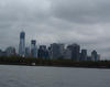
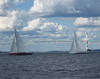
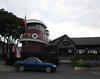
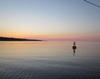
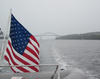
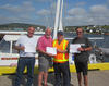
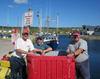
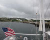
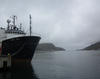
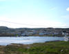
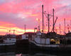
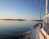
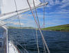
LIMMERSHIN HAS RETURNED! Docking at 1545 today, Limmershin returns from a 4100+ nm odyssey around Newfoundland with a far port of Battle Harbor, Labrador. |
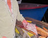
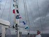 All the flags Limmershin flew!
|
||||||||
| Monday October 1, 2012 |
Worton Creek, MD
|
Out of Cape May Harbor on the ocean side at 0615, Limmershin rounded the lighthouse and grabbed the favorable current up the Delaware Bay toward the C & D Canal. We were making such good time that we continued all the way into Worton Creek on the upper Chesapeake Bay. The total distance was 93 nm in 11 hours for an average speed of just under 9 knots - pretty fast!
|
No photos. Everyone has already seen the Delaware Bay!
|
||||||||
| Sunday September 30, 2012 |
Cape May, NJ
|
Sailing the New Jersey coast is about as interesting as driving the New Jersey Turnpike. Today, we covered the 83 nm distance from Manasquan to Cape May. It was uneventful (i.e. boring) but represents a big chunk of distance on the trip home.
Limmershin anchored near the Coast Guard station in Cape May harbor and will round he cape early tomorrow heading up the Delaware Bay. |
No photos. New Jersey still looks the same.
|
||||||||
| Saturday September 29, 2012 |
Manasquan, NJ
|
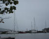
It was still misty and damp this morning as Limmershin moved out of City Island to catch the southbound current down the East River past Manhattan. Over two inches of rain were reported for yesterday's storm on Long Island Sound.
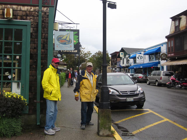
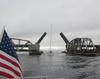
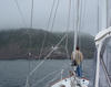
After being told yesterday by the Coast Guard that the East River west of Roosevelt Island was closed to recreational vessels because of the UN General Assembly session, we emerged from Hell Gate and heard a radio conversation between another boat and The New York Harbor Authority stating that it was possible to travel west of the island. Since this would avoid the drawbridge, and the worst we could get was a long sentence to Guantanamo Bay, we followed along. Sure enough, the Coast Guard was there telling boats to remain 175 meters away from the Manhattan shore while passing. It's comforting to know that Homeland Security has a such grip on their plans that they themselves don't know that the river is open! It's always interesting to sail past Manhattan with all there is to see. Limmershin carried a nice favorable current all the way down past The Battery, the Verrazano Narrows Bridge, and Sandy Hook into Manasquan Inlet where we tied up at Brielle Marina. |
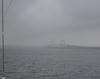 A misty start down the Est River.
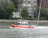 USCG escort for Limmershin.
 Lower Manhattan.
|
||||||||
| Friday September 28, 2012 |
City Island, New York City, NY
|
Made it to City Island today through heavy rain arriving at Consolidated Shipyard by 1300 hrs. Tomorrow, down the East River through Hell Gate, but east of Roosevelt Island because the Coast Guard has the west side closed for UN General Assembly. We hope the draw bridge will come up on time since we will be going with the current, but the Coast Guard really doesn't care. If we survive Homeland Security, we will be in Masasquan, NJ, tomorrow night. |
No photos, rain hurts the camera!
|
||||||||
| Thursday September 27, 2012 |
Port Jefferson, Long Island, NY
|
Back on the road again, Limmershin covered 75 nm into Port Jefferson today. As hoped for, the wind at 0430 this morning had moderated enough for us to strike out for The Race before the favorable current reversed itself. We made our way out of the Point Judith harbor and breakwater in total darkness and, at 0515, found the sea state to be settled enough to make good speed westbound.
Eventually the wind totally diminished and the sun appeared in the afternoon. Even though we were bucking a 1 to 1.5 current from late morning on, we covered the distance to Port Jefferson in good time, arriving at 1530 hours. Limmershin will rest on a mooring tonight and amble the 35 nm into City Island tomorrow. |
 Little Gull Island in The Race.
 Port Jefferson mooring.
|
||||||||
| Wednesday September 26, 2012 |
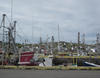
Point Judith, RI
|
A layover day here in Point Judith waiting for the front to pass tonight. There isn't a town or village within walking distance, so we have remained close to the boat doing chores like laundry, vacuuming, and refrigerator light replacement.
The current runs in our favor through The Race from 0430 to 1030, so it will be an early departure to cover the 25 nm to get there and beyond the reach of the current. |
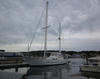
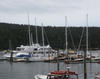
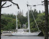
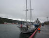
 Limmershin at the Point Judith Marina.
|
||||||||
| Tuesday September 25, 2012 |
Point Judith, RI
|
Limmershin's string of high mileage days came to an abrupt end today. We covered a measly 9 nm going from Newport to Point Judith!
With a forecast of SW 10-15 kt, gusting to 20 kt in the afternoon, we hoped to get to Fishers Island, across The Race (a high current bottleneck in Long Island Sound) with slack or following current before the afternoon gales developed. Not to be. By 0830, when we were only ~6 nm out of Newport, the wind grew to 20 knots and we found ourselves pounding through head winds and head seas at ~4 kt with the onset of foul current looming. Suddenly, Point Judith looked pretty good so we are tied up well inside the Harbor of Refuge at a first class marina. The forecast for tomorrow is for more of the same, only worse, so we will likely get going again on Thursday. That will surely delay Limmershin's arrival back in Maryland to maybe Tuesday or Wednesday of next week (good thing no one onboard has to get back for work!). |
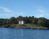
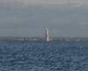
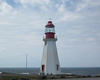
 The light at the Harbor of Refuge.
 No more sailing today!.
 The old Point Judith light.
|
||||||||
| Monday September 24, 2012 |
Newport, RI
|
Limmershin continues to bite off big chunks of mileage as the weather cooperates and the crew pushes homeward. Today we covered 75 nm having left at 0430 and, despite a case of sea sludge clogging the engine's seawater cooling system, arriving in Newport well before cocktail hour. While waiting for the engine to cool down (and for the sun to come up), we were fortunate to have a good 10 knot wind on the starboard beam so we sailed at 6-7 knots from Provincetown to the Cape Cod Canal entrance with no motor assist. Sean remedied the engine problem by the time we reached the canal in time to capatalize on a hefty 2-4 knot push that lasted most of the way down Buzzards Bay.
Being pleased to find that the Newport Yachting Center actually had off-season rates in place of their normally exhorbinant wharfage, we pulled up. The Norwegians were to meet us at the Black Pearl, but after we downed two Dark and Stormies, we gave up on them and went to Yesterdays Pub for dinner. It lived up to expectations with excellent food in large portions for a reasonable price, all in an old time atmosphere. This is Infrared's favorite eating spot in Newport. |
 Cape Cod Canal.
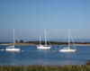
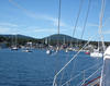
 12 Meter yachts greet Limmershin approaching Newport.
|
||||||||
| Sunday September 23, 2012 |
Provincetown, MA
|
The next several days will likely get us bigger mileage totals and today was the of these, with 65 nm from Boothbay Harbor to the Isles of Shoals. These islands are exactly on the border between Maine and New Hampshire and some of the islands are in each state, so, in Gosport Harbor, we think we are in New Hampshire, but it probably depends on where we are moored. Anyway, we are either out of Maine or as close as possible to it.
Today was a pretty dull voyage with clouds and patchy fog through mid afternoon. Light and variable winds assured that it would be motor sailing all the way. Not much good for sightseeing or picture taking. Limmershin is back offshore so the route was straight so navigation was easy. About the time we arrived at the Isles of Shoals, however, the clouds and fog lifted and we sailed into the harbor with ease. Amazingly, the only marina in town had already pulled their floating docks so we took a mooring. Even more amazingly, we spotted the Astahaya boys just preparing to drop a mooring and head out for Newport. So one again, our paths have crossed! They recommended a restaurant called The Mews. Since we were leaving the next morning at 0500 hours to catch the southbound current through the Cape Cod Canal, we arrived at the restaurant early and that turned out to be a good idea since it filled up immediately thereafter. It was the best food we have had (not cooked by George) since St. Pierre. None on board could stay up late enough for the Ravens and Patriots game on television. |
 Provincetown.
 Astahaya boys in P-town. |
||||||||
| Saturday September 22, 2012 |
Gosport Harbor, Isles of Shoals, NH
|
The next several days will likely get us bigger mileage totals and today was the of these, with 65 nm from Boothbay Harbor to the Isles of Shoals. These islands are exactly on the border between Maine and New Hampshire and some of the islands are in each state, so, in Gosport Harbor, we think we are in New Hampshire, but it probably depends on where we are moored. Anyway, we are either out of Maine or as close as possible to it.
Today was a pretty dull voyage with clouds and patchy fog through mid afternoon. Light and variable winds assured that it would be motor sailing all the way. Not much good for sightseeing or picture taking. Limmershin is back offshore so the route was straight so navigation was easy. About the time we arrived at the Isles of Shoals, howevr, the clouds and fog lifted and
|
 The Isles of Shoals.
 On a mooring in Gosport Harbor.
|
||||||||
| Friday September 21, 2012 |
Boothbay Harbor, ME
|
Another 43 nm, easy day trip from Camden brought us to Boothbay Harbor. While not as involved as yesterday, there were a few winding routes to navigate: Owls Head Bay, Muscle Ridge Channel, and Fisherman Island Passage. This brought us down Penobscot Bay, past Muscongus Bay, and into Booth Bay. These waters have a very high density of lobster pots (way greater than the density of crab pots on the Chesapeake), so dodging was the order of the day.
Wharfage was provided by the Tug Boat Inn & Marina, and there was plenty of space. Boothbay Harbor is packed with recreational boats during the summer season, but that has ended and the harbor is now almost empty. In town, most of the businesses are tourist oriented and most are still open, so we had lots to see and options for dinner. We hope to put some significant mileage behind us over the next few days since the weather looks cooperative and we ae passing ports that we have already visited. Tomorrow will be a stop over at anchor or mooring in the Isle of Shoals and then on to Provincetown on Sunday.
|
 Tugboat Inn.
 Boothbay Harbor wharfage.
|
||||||||
| Thursday September 20, 2012 |
Camden, ME
|
It was a short jaunt from Northeast Harbor to Camden, Maine, being only 43 nm, but the real fun was negotiating Casco Passage, Deer Island Thorofare, and Fox Island Thorofare. These are narrow passages through the many islands, rocks, and shoals and they connect one bay to another along this part of the Maine coast. So we were not sailing offshore, but rather on an inshore route. Today, the visibility was excellent, sunshine and blue sky, so navigating was straight forward since the marks were easy to spot from a good distance. (The chart plotters were also very helpful!)
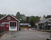
Camden is one of the nicest towns in Maine. Having once been a prosperous manufacturing and seafaring center, it has old, well built commercial buildings, homes, parks, and gardens that still look good today.
|
 Curtis Island light.
 Camden Harbor.
|
||||||||
| Wednesday September 19, 2012 |
Mt. Desert Island, Northeast Harbor, ME
|
Off shore winds last night were above 30 knots, but in Northeast Harbor it was hardly noticible. On the other hand, we did get a load of rain lasting into this morning. Sunshine returned in the early afternoon.
Mt. Desert Island, which is home to Acadia National Park, has a free bus service that connects all the villages (Bar Harbor, Southwest Harbor, Northwest Harbor, et. al.) and is an ideal way to get around and see the sights. Today, we went into Bar Harbor on a very scenic route that went by Jordan Lake and close to Cadillac Mountain. After looking around town, we went to lunch at Stewmans Lobster Pound on the waterfront. After lunch, we came back to Northeast Harbor and reinstalled the mainsail on the repaired furler, so we are ready to go to Camden in the morning.
|
 Tourists.
 Bar Harbor lunch spot.
|
||||||||
| Tuesday September 18, 2012 |
Mt. Desert Island, Southwest Harbor, ME
|
 Limmershin is back in the USA!
Limmershin left Yarmouth at 1700 hours for an overnight trip across the Gulf of Maine. That choice was dictated by a need to arrive in daylight, get there before the gale set in, and avoid the lingering headwinds...it was a small window. The plan worked out just great. We arrived at dawn after a night of light air and generally well behaved seas (remember this is where the hugh currents from the Bay of Fundy can raise turbulent hell!). Because we needed to get the main sail rig repaired, we landed at Southwest Harbor where the Hinckley Yacht yard had said they could help us. They were true to their word and the rig was repaired and installed by 1800 this afternoon. However, the gale is still bearing down on us, so we couldn't stay at the exposed Hinckley wharf. Rather than take a mooring and ride out the winds bouncing away the night, the navigator called the Northeast Harbor master and arranged for a slip in the most sheltered spot on the island. So Limmershin is happily ensconced in splendid comfort awaiting the gale (BTW the same gale that blew through Maryland last night). |
 Sunrise in the USA!
 Where the main was repaired.
 THE place to ride out a gale!
|
||||||||
| Monday September 17, 2012 |
Yarmouth, NS

|
We expect to leave this afternoon around 1700 hours for the overnight trip to Southwest Harbor, Maine. Until then, we have to find ways to get rid of what's left of our Canadian money. |
No photos yet.
|
||||||||
| Sunday September 16, 2012 |
Yarmouth, NS
|
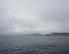
The front came through on time last night and the wind has been blowing from the northwest and west all day, so there was never a question of our staying here today.
The sun has been out all day, so it was not so bad. The town seems to be weathering the loss of the ferry services as well as can be expected. While there are a number of business vacancies, there remain quite a few whose doors are open and the town seems upbeat. The weather may present a window for us to cross the Gulf of Maine late tomorrow. It's about a 15 hour crossing, so leaving in the evening would put us there in daylight.
|
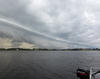 The front (pt. 1)
 The front (pt. 2)
|
||||||||
| Saturday September 15, 2012 |
Yarmouth, NS
|
We have finally arrived at the last port of call in Canada: Yarmouth, Nova Scotia. Timing the currents around Cape Sable, required a 0330 departure in total darkness from Lockeport and we got a good lift pushing Limmershin to a high of 10 knots of boat speed while rounding the legendary Cape Sable. But the current seemed to reverse early and we plodded the last two hours through an adverse current of more than 2 knots. The fair weather, however, allowed us to run the Schooner Passage through the Tusket Islands in perfect visibility, a really nice passage.
A front this evening will bring on westerly winds which are bad for us since the next leg is westward across the Gulf of Maine to Mt. Desert Isand. Thus, we will likely be here until Tuesday. Yarmouth has been hammered by the closing of both ferry services whose comings and goings supported the town for so long. Both the Scotia Prince, a steamship ferry from Portland, and The Cat, a catamaran high speed ferry from Bar Harbor, closed down in the last several years. It was uncertain what to expect when we arrived given the depressed state of the local economy, but we were delighted to find the marina had been upgraded so Limmershin had no problem getting wharf side accommodation at Kellam's Wharf.
|
 Cape Sable.
 Entering Schooner Pasage
|
||||||||
| Friday September 14, 2012 |
Lockeport, NS
|
It's not a long journey from Liverpool to Lockeport, but we left early (mostly because Maryland Eastern Shore guys actually like getting up at 0500 and the rest of the crew is hopelessly outnumbered). So we were here for lunch.
Lockeport doesn't get much respect from authors of cruising guides, but it's one of Bob's favorite places. It is not far "from the highway" so it's easy in/easy out. There are good (but, not fancy) floating docks. At the end of the dock is a restaurant, a liquor store, a hardware store, and a grocery store is one block away. The town is friendly and tidy. What's not to like? Getting Limmershin back to Maine requires overcoming three impediments: 1. finding a time when the wind in not howling on the nose, 2. getting around Cape Sable with the current (sometimes up to 6 knots) in our favor, and 3. avoiding the next stormy frontal passage. To deal with this, we chose Lockeport as out staging area for the move around Cape Sable: it's a good port close to the cape. We will defeat the headwind and go with the current by leaving tomorrow at 0300 hours. It's 72 nm to Yarmouth so we expect to be there in the early afternoon. |
 Early departure from Brooklyn.
 A rocky passage into Lockporte.
|
||||||||
| Thursday September 13, 2012 |
Liverpool/Brooklyn, NS
|
We left Halifax with the threat of strong southwesterly winds developing as the day wore on. So we originally set a course for Lockeport, 75 nm away, figuring that we mght be able to get around Cape Sable on Friday, maybe even go all the way over to Maine if things went just right. Well, Maritime Canada doesn't want to let Limmershin go so easily, if fact, she has been fighting our departure for some time now (remember the gales in St. Lawrence, the remains of hurricane Isaac in Baddeck, and Leslie in Liscomb?).
So, completely in character, the wind powered up right on the nose. Anticipating such a development, we had bail-out positions. One of which was to fall off the wind and go into Liverpool Bay (where we had stopped on the way out at the Brooklyn Marina). This we did and it was none too soon that we tied up. While motorsailing that afternoon, the fitting that holds up the main sail furling system broke. We were able to roll up the sail since the halyard still supported the sail and furler. When in the marina, however, we took the whole rig down, unrolled and detached the sail and stowed the furler on deck. We hope to get it repaired at Southwest Harbor in Maine. |
 Brooklyn Marina.
|
||||||||
| Wednesday September 12, 2012 |
Halifax, NS
|
Although the sun came out yesterday afternoon, the reports of 20+ foot seas kept us ashore until this morning. We scheduled a first light departure, but were slowed a little by some fog making it impossible to find the tiny buoys marking the river access away from the lodge wharf. Not too bad though, the fog lifted promptly and we were away by 0630 for the 80 nm jaunt to Halifax. During this whole trip, we have been bedeviled by adverse wind and tides and today was no exception. Although not horrible, we were bucking both all the way into Halifax.
We are tied up at the Royal Nova Scotia Yacht Squadron once again, but only for one night. This high pressure system ought to give us an opportunity to put some more miles under the keel before the next weather adventure arrives. It's probably three or four more sailing days before we get to Maine so we can't visit here too long.
|
 Liscomb bye bye
 The inshore passage.
|
||||||||
| Tuesday September 11, 2012 |
Liscombe Lodge, NS
|
Pouring, really pouring, rain this morning added to the totals we got yesterday. So far no flooding problems in our locality, but the constant rain for the last 36 hours has soaked much of the boat with condensation. As planned, we have been well sheltered from the winds of Leslie which passed 150 - 200 nm offshore.
By the afternoon, the rain let up and the sun actually came out! Still 15 to 20 ft seas on the outside, so we will wait for tomorrow to go to Halifax. By the way, it's not careless spelling, but the harbor, town, river, and bay are all spelled "Liscomb", however the lodge is the "Liscombe" Lodge. Also, we Americans spell it "harbor", but Canadians spell it "harbour". It's tough being an American writing about Canadian stuff that's not hockey. |
Pictures of rain are not that interesting.
|
||||||||
| Sunday September 9, 2012 |
Liscombe Lodge, NS
|
This morning's look at the weather confirmed that it was an excellent idea to run for Liscombe yesterday. We will probably be here until Wednesday as hurricane Leslie passes off shore headed for Newfoundland. Unfortunately, it looks like our recent favorite town, St. Lawrence, Newfoundland, will be ground zero at impact. As honarary St. Lawrence Harbour Authority members, we are very worried, but know Sam, Brian, and Colin will handle it just fine.
One of the pleasures of the Liscombe Lodge is the wharf manger, Chester Rudolph, certainly one of the best hosts a visiting boat crew can encounter. Having been here before, we called ahead to make sure we would have dock space and Chester insured it with a hand made "Reserved!" sign. We are actually about three miles up the Liscomb River from the harbor, in a small valley that affords maximum protection from big winds. |
 Good reason to hide!
 Good hideout!
|
||||||||
| Saturday September 8, 2012 |
Liscombe Lodge, NS
|
With the weather threatening as it is, we made a long jump from St.Peters to Liscomb. Leslie is lurking off the Atlantic coast, but there are some other gales forecast to blow through here in the next couple of days. So we are happy to be at the Liscomb Lodge wharf with plenty of shelter and all those amenities available, too. This is the safest hiding hole on the whole Eastern Shore of Nova Scotia and we are securely tied to the main wharf. So it ought to be just an inconvient weather delay for us since we will likely be here until Wednesday.
The passage went quite well when the threatened on-the-nose winds behaved, but we did have a full one knot foul current the whole way! Oh, well, it still worked out and we are here. |
No interesting pictures today!
|
||||||||
| Friday September 7, 2012 |
St. Peters, NS
|
Limmershin made the short (~35 nm) run down the Bras d'Or to St. Peters today. The nasty weather of yesterday is gone and we will leave tomorrow probably to stay at anchor in Portage Cove in Andrew Passage or Tor Bay depending on how the wind blows. The forecast is for southwesterly around 20 knots which will be on our nose thus motivating an early end to the days sailing.
The news on Leslie is encouraging with the latest forcast keeping the worst sufficiently off shore and moving more slowly. We are still going to hide out Sunday night in Liscomb at the lodge just in case she changes her mind. Plus, maybe we can get some planked salmon! The Astahaya boys left Baddeck with us but kept going through the canal hoping to blast through to Halifax. |
 The Astahaya boys.
 Barre Strait bridge.
|
||||||||
| Thursday September 6, 2012 |
Baddeck, NS
|
It was still rainy and blowing early this morning so we are staying, hoping to get to St. Peters tomorrow. What happens beyond that will depend on what hurricane Leslie has in mind for Nova Scotia. Needless to say, we are watching closely and considering various places to hide out if she doesn't veer out to sea. So far all of our weather related planning has worked out well, including this event, but Leslie may be the real test. |
 Waiting out the storm in Baddeck.
 Baddeck wharf scene.
|
||||||||
| Wednesday September 5, 2012 |
Baddeck, NS
|
Limmershin departed from St. Pierre yesterday at 0700 for the 180 nm crossing of the 250 fathom deep Laurential Trough to Cape Breton. We noted that it was September 4 when we left and it was July 4 when we arrived, a nice bit of symmetry. The July crossing was completely in the fog whereas this one was completely under clear skies, plenty of sun during the day and bright starlight overnight accompanied by an impressive display of the Aurora Borealis.
As the the laws of improbable events go (with only two vessels on a vast body of water, they will be on a collision course), we saw only three other vessels during the entire ~24 hour trip. We passed ~1 nm from a large cargo ship in daylight and ~0.25 nm from a fishing boat in darkness, (the third boat was distant). We were required to go to Sydney to clear Canadian Customs since that is the local port of entry. That we did, but with a degenerating weather picture, we decided to stay only long enough to gain entry and then run for Baddeck. On the way, rain began but, more importantly, wind held off. That weather system may keep us in Baddeck tomorrow before we go the rest of the way down the Bras d'Or to St. Peters. We had already researched the currents in the Great Bras d'Or, a fairly narrow channel leading to sea from the lakes, and knew that it would be in our favor. We logged speeds as high as 10.5 knots pushing us along into Baddeck. At 2100 hours, it's blowing a gale. We pulled the Norwegian Oyster guys into the dock so all are awaiting calmer conditions in the morning. |
 Laurentian sunrise.
 Customs officers board Limmershin.
 Seal Is. Bridge, once again.
|
||||||||
| Monday September 3, 2012 |
St. Pierre, France


|
With an agreeable weather window extending into Thursday, we decided to stay an extra day in St. Pierre so we could see more of the place and stock up on pate, cognac, fromage, and confit de canard. Unfortunately, Canadian customs will limit the amount of alcohol we can take into their country, but we at least want to get the minimum.
Also, there are no bad restaurants in France and that includes St. Pierre, so we will take full advantage of that. Included here are some scenes from St. Pierre.
|
 Captains of the Port!
 The boucherie.
|
||||||||
| Sunday September 2, 2012 |
St. Pierre, France
|
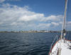
Almost exactly two months ago Limmershin arrived in St. Pierre on the way to Newfoundland and this morning at 1130 AST, Limmershin returned, thus closing the loop around "The Rock". It was time to leave St. Lawrence after eight days waiting out the southwesterly gales, but the stay was made a pleasure by the people we befriended there. We have been looking forward to St. Pierre because of the good food both in the restaurants and the shops, and the other amenities of the French environment (n.b. chocolate and liquor). Unless there is a change in the weather outlook, we will stay over tomorrow and do an overnight passage to Cape Breton on Tuesday through Wednesday.
|
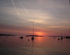
 St. Lawrence getaway.
 Arriving at St. Pierre.
|
||||||||
| Friday August 31, 2012 |
St. Lawrence, NL
|
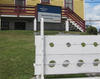
We have been here so long that, not only do we qualify for the annual wharfage rate, but the boys have made us honorary members of the St. Lawrence Harbour Authority!
Later we went for a hike over the ridge to see Little St. Lawrence. It's a much smaller town but the harbor is about the same size and equally scenic. There is no wharfage, but a good looking anchorage at the head of the bay, where there is also a small hydroelectric dam. It looks dim for getting out tomorrow. The wind shift probably won't come until after sunset, so Sunday looks like the getaway day to St. Pierre. |
 We're now official!
 Little St. Lawrence.
|
||||||||
| Thursday August 30, 2012 |
St. Lawrence, NL
|
For a while it looked like there might be a small weather window that would allow us to scurry over to St. Pierre on Friday morning. We awoke this morning to find that window slammed shut. So it looks like Saturday midday could be the next opportunity. Weather events hereabouts have a way of changing rapidly so we will keep watching and see what happens.
|
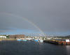 St. Lawrence rainbow.
|
||||||||
| Wednesday August 29, 2012 |
St. Lawrence, NL
|
As if to make the point even more emphatically, the wind from the southwest roared even harder today. The irony is that, otherwise, the weather is really nice. The sky is bright blue and the visibility could not be better, it is amazingly clear. Again, as in other parts of Newfoundland, people have told us that this has been the most unusual summer in memory for its wealth of good weather.
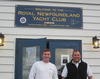
Just about sunset yesterday, we were surprised to find Astahaya, the Norwegian Oyster 56 with Thom and Christian on board, arriving at our wharf. After helping them tie up, they told of leaving The Royal Newfoundland Yacht Club at Long Pond and sailing all the way here. Their trip down the east coast was a good ride with a beam reach speeding them along, but the last ~80 nm from Cape Race to here was very rough with strong headwinds and seasickness inducing waves and turbulence (exactly why we have been staying). We first spotted them in the Cape Cod Canal back in June and then again near Gros Morne on the west coast of Newfoundland. We have been playing tag ever since and it has been a delight to run into them again and again. Sean decided that Chapeau Rouge was too imposing to ignore and declared his intention to climb it. Bob and George, neither needing psychiatric care, declined the invitation. Sean did it and is recovering nicely. |
 Astahaya is here!
 The wharf staff.
 Sean climbed it.
|
||||||||
| Tuesday August 28, 2012 |
St. Lawrence, NL
|
Wind still blowing, Limmershin still staying. It is the North Atlantic, when it talks, we listen.
Yesterday, we pursued the story of the USS Truxton, USS Pollux, and the USS Wilkes which crashed on the rocks in the winter of 1942. Today, we learned more about the fluorite mining that was an important industry at various times since the 1930's. It was the miners who were the heros of the rescue. Fluorspar (also called Fluorite, CaF2), used primarily in smelting of iron and aluminum, was discovered here in 1928 and it turned out to be the biggest deposit in North America. The mines florished at times, especially during the war years, but the effects of radon gas in the mines took a terrible toll on the miners. We have been told here that every one of the miners involved in the rescue died in the Memorial Hospital that the US built, almost all from radiation induced cancers. Eventually, the Canadian government stepped in, making survivors benefits available and forcing tougher ventilation and monitoring standards. The mines opened again in the 1980's, but closed in the '90's. There is currently a move being made to re-open the mines. |
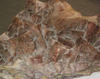 Fluorspar.
 More Fluorspar.
 Gemologists at work.
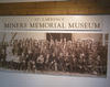 The miners.
|
||||||||
| Monday August 27, 2012 |
St. Lawrence, NL
|
Wind still blowing, Limmershin still staying.
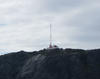
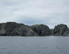
St. Lawrence has a bit of interesting history. There was a terrible ship wreck during WW II in which three American ships ran on the rocks during a February blizzard. The destroyers USS Truxton and USS Wilkes were escorting the supply ship USS Pollux into the Naval Base at Argentia when, at 0415 on February 18, 1942, while a blizzard was raging, they ran agound on the unforgiving, rocky shore. The Wilkes was able to back off, but the Truxton and Pollux broke up and sank. Of the 389 total crew on the two ships, 186 were saved by the citizens of St. Lawrence and neighboring Lawn. Under truly horrible conditions, miners working nearby pulled the Truxton survivors up a 300 foot precipice and transported them into town where the women cleaned, warmed, and revived the survivors. After the war, in gratitude, the US Government built a hospital in St. Lawrence that still operates today. Local good guy, Jerome Slaney, volunteered to drive us out to Chambers Cove, the scene of the Truxton disaster for a look at the incredibly rugged shore. the citizens are still justly proud of their ancestor's heroism in the rescue. Tomorrow we will likely go to the museum and visit the hospital.
|
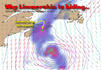
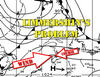 Wind, the map.
 Site of the USS Truxton disaster.
 Location of impact.
|
||||||||
| Sunday August 26, 2012 |
St. Lawrence, NL
|
Limmershin can't get off the rock! Persistent head winds above 20 knots have trapped us here in St. Lawrence, our last stop in Newfoundland. The forecast is bleak with the expectation that the adverse winds will continue at least through mid-week. So we may get a good chance to thoroughly explore St. Lawrence.
This morning, we made an attempt to get out while the winds were relaxed in the early morning. It's only ~38 nm to St. Pierre, which six hours or less, so we left in the dark at 0445, but it was not to be. Already the wind beyond the headlands was blowing too strongly and directly from our course direction that we turned back and re-secured at the wharf. Better than getting beat up. |
 St. Lawrence exit.
 Not this time.
|
||||||||
| Saturday August 25, 2012 |
St. Lawrence, NL
|
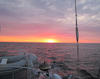
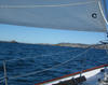
A break in the southwesterly winds seemed likely, so we left Trepassey at 0530 hours (yes, it was dark!) hoping to take advantage of the usually light morning breeze and then the expected 20 knot north wind. The trip was ~90 nm which is a long day for Limmershin and it all worked out just fine. As we turned around Cape Pine to go west, the wind filled in from the north, which is the kind of beam reach Limmershin likes, and we sailed along at 8.5-9 knots up until early afternoon. As the wind weakened, at least it didn't go forward and on the nose, so we motored along until the last hour or so when the breeze turned southwest allowing us to unfurl the genoa again. So we knocked off a big hunk of distance in a good, painless day of sailing.
With a 4 day southwesterly blow expected, we will probably scoot for St. Pierre before sunrise tomorrow. |
 Dawn get away.
 Back to the rocky part of Newfoundland.
 George's diplomacy.
|
||||||||
| Friday August 24, 2012 |
Trepassey, NL
|
The forecast was correct, this afternoon the wind went west at 20 knots and our decision to wait for tomorow to leave for St. Lawrence on the Burin Penninsula turned out to be a wise one. A 90 nm slog to windward is no fun. At 1700 hours, it was, indeed, blowing at 20+ knots from our intended direction.
We got a quick tour around Trepassey with a local seaman, "Jimmy" Dean" who drove us up to a hill on the penninsula at the harbor entrance for a good view of the town, and then over to the now defunct fish plant about seven miles away on the opposite side of the bay. He confirmed what we had been told, Trepassey is long past its glory days when that fish plant was operating and the town is losing population. It seems like we're on the Amelia Earhart tour. In 1928, she launched her first trans-Atlantic flight from here in Trepassey and then, in 1932, she took off for her solo crossing from Harbor Grace where we visited last Saturday. An interesting tidbit for us, but she is still missing. |
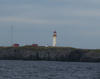
 Trepassey light from behind.
 Big view of Trepassey.
 Closer view of Trepassey.
|
||||||||
| Thursday August 23, 2012 |
Trepassey, NL
|
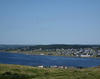
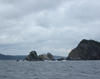
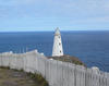
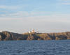
Today Limmershin rounded the southeast corner of Newfoundland at Cape Race and turned west. Adequate harbors become pretty scarce hereabouts but Trepassey has turned out to be just fine. The wharf is solid, sheltered, and clean (but no showers) and the town, while rapidly shrinking, still supports a liquor store, small grocery, and library.
Sailing down the east coast, we passed Renews Harbour where the Pilgrims originally set foot in North America before continuing on to Provincetown, Massachusetts, and then on to Plymouth Rock. Also of interest to Maryland residents, is the settlement of Ferryland which we also passed. In 1625, Lord Baltimore established a colony with more than 100 settlers trying to farm and fish. In 1628, he brought more Catholics and his family over, hoping to establish a bulwark against Protestantism in the region. But in 1629, beset by crop failures, religious strife, attacks by Indians and French pirates, Baltimore up and moved to Maryland (some say his wife was the main motivator for the move) and the rest is Maryland history.
|
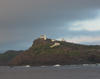
 The notorious Cape Race.
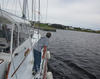 Bring it in to the dock.
|
||||||||
| Wednesday August 22, 2012 |
Fermeuse, NL
|
Patrick and Jason jumped in a cab for the airport at 0500 this morning, so Limmershin executed a vamoose for Fermeuse (sounds like a rock concert tour!). We arrived shortly after noon and tied up to the subatantial government wharf.
It turned out to be a fine, sunhine filled afternoon and Fermeuse harbour was quite nice. The town is small, a few hundred, but clean and seemingly cheerful. There was only a gas station and convenience store out on the two lane highway, and we never did get the harbor master to answer our call. In all though, it was a good stopover port
|
 Cape Speer from the sea.
 Lord Baltimore's first stop.
|
||||||||
| Tuesday August 21, 2012 |
St. Johns, NL
|
As expected, rain overnight and continuing this morning confirms that it was a good idea to come here yesterday morning. Today will be another day to be a tourist and lounge around before Patrick and Jason fly out early tomorrow. Then, Limmershin will head south.
For lunch, we finally had to try some local poutine. Originally, it was much like the Baltimore concoction of fries with gravy, but the Canadians went on to add cheese and meat. Probably a major contributor to heftiness, it is very popular and actually tastes pretty good! |
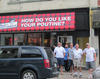 Poutine is a health food?
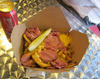 It's a beautiful thing.
|
||||||||
| Monday August 20, 2012 |
St. Johns, NL
|
To be sure that Jason and Patrick would make their early morning Tuesday flight home, Limmershin made the move out of Carbonear, around Cape St. Francis, and down the east coast into St. Johns. Tuesday's weather looked bleak, with rain and strong headwinds. Since the forecast for today was for 15-20 kt winds setting up from the south (on the nose), it was another predawn departure, but that also meant an early arrival.
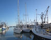
Our early contact with the Harbor Authority seems to have paid off since traffic control directed us to a good spot on the main wharf at Pier 8. St. Johns is not a yachting center by any means. We are tied up to the same wharf used by cruise ships and various fishing and freighter vessels, but we are one block off Water Street and very close to George Street. During the afternoon, we walked around downtown doing the usual tourist stuff. St. Johns is a very old town dating back to the 1500's and was the commercial center in the heyday of the Newfoundland fishery. It has every sign of being an old hard working town. Even though there is plenty of rock, virtually all buildings are wooden and compactly spaced, much like the older sections of Boston. The crew ate supper at The Keg, a steakhouse just down the wharf. What was impressive was the quality of the beef and its preparation. Canada actually had a regulation prohibiting beef from being served at anything less than well done, so ordering a steak or burger was a waste of money. This also served to train the folks here to abhor red beef. Evidently, things are changing. The food we had was excellent, not cheap, but worth it. |
 Cape Francis in the morning.
 Ft. Amherst guards St. Johns.
 Limmershin in St. Johns.
|
||||||||
| Sunday August 19, 2012 |
Carbonear, NL
|
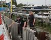
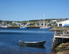
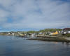
Carbonear is only a few miles from Harbor Grace, so it was a quick trip. When we arrived, however, the wharf was packed with fishing boats so, as we have done before, we tracked down the harbor master and convinced him that it was possible to move and stack boats and get Limmershin a dockside spot. Otherwise, Carbonear didn't have much to impress. It seems a tired town whose history is long past.
Carbonear (and Harbor Grace, to a lesser extent) is the only place I have been in Atlantic Canada that had all the sadness and deterioration of Appalachia. The buildings and homes are rundown, the infrastructure is crumbling, and the people, while not hostile, lack the customary outgoing friendliness encountered elsewhere. Not a place to tarry. |
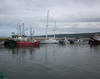 Limmershin wedged into a wharf spot.
|
||||||||
| Saturday August 18, 2012 |
Harbour Grace, NL
|
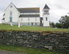
It's not far, less than 10 nm, from Brigus to Harbor Grace, but a lumpy sea and gusty wind on, or close to, the nose can make it seem eternally distant. The two hour slog was nausea inducing and, if it were to have lasted much longer, perhaps mal de mer inducing.
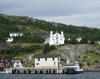
Limmershin arrived at the public wharf around 1300 hours and we went for a walking tour after lunch. Harbour Grace was a very prosperous merchantile port in the 19th century and signs of those glory days still exist. A huge Catholic cathederal, that of the Immaculate Conception, was in serious disrepair. Whether it can be restored seems a less than even money bet, but they appear to be trying. While there are plenty of humble dwellings, a number of large Victorian houses still remain, many serving as B&B's.
|
 Nasty trip to Harbor Grace.
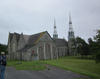 The Cathederal.
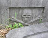 Pirate from Harbour Garce?
|
||||||||
| Friday August 17, 2012 |
Brigus, NL
|
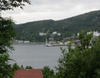
Limmershin made the move out of the Royal Newfoundland Yacht Club just before noon destined for the town of Brigus about 10 nm toward the head of Conception Bay. While the yacht club was a congenial place, we had been there a full week so it was time to move on.
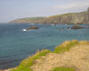
The wind was favorable and brisk so Limmershin had a fine sail all the way across the bay and in beyond Brigus' headlands. We lowered sail and tied up at the government wharf and headed into town for a walking tour. The topography here is once again rugged, rocky, and vertical. The village is reminescent of those in Maine situated on rocky shores with houses lanes scattered among the rocky outcrops. One thing that is different from other Newfoundland villages is the number of modern, recently constructed residences on the most attractive waterfront lots, probably a result of proximity to the St. Johns metro area. Brigus was once the center of the Newfoundland sealing industry and, of course, supported an inshore fishing fleet, but those activities are long gone. During the hike, some rain settled in and the wind began picking up. Soon Limmershin was bouncing uncomfortably at the exposed wharf, so we decided to move into the compact inner part of the harbor and take one of the moorings found there.
|
 Brigus headlands.
 Brigus behind Limmershin.
 Anglican church.
|
||||||||
| Thursday August 16, 2012 |
Long Pond, NL
|
Jason and Patrick arrived from Maryland by way of several airports in Canada (and maybe a few other countries) late yesterday afternoon after a predawn departure. Once they found their quarters on Limmershin, we took them to the yacht club bar for an inaugural shot (or two) of Screech, the traditional Newfoundland rum. Then, it was George's Moose Chili for all. George has perfected the recipe and, although we haven't yet exhaused our onboard supply, we will have to find a source of moose meat in Maryland when we get back.
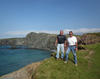
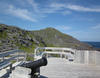
After a leisurely breakfast, we all piled into the Nissan Altima for an "almost-a-clown-car" experience. The Altima is a little bigger in the back seat than the Cape Breton Hyundai and our travel legs weren't as long, but five big guys can still fill up a sedan. Off we went to get a look at a couple of potential harbors for Limmershin below St. Johns. Both Bay Bulls and Petty Harbour were interesting and scenic, but will only be used in an emergency. Next, it was a visit to Cape Speer, the eastern most point on the North American continent. One again, the weather was amazingly cooperative and the viewing was spectacular. Lighthouses have their own attraction, but in the case of these east coast Newfoundland lights, the elevation and massive rocky prominences provide some stunning scenes. After lunch in St. Johns, George and Bob paid a visit to the Harbour Masters office to arrange wharfage for Limmershin early next week. The people there could not have been more cooperative, assuring us that space would be available in the sheltered part of the harbor. So the plan is to return there so Patrick and Jason can make their flight home early Wednesday morning.
|
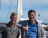
 Patrick & Jason in Newfoundland.
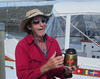
 Screech for all!
 Can't go farther east.
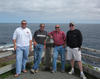 Limmershin's crew in the east.
|
||||||||
| Wednesday August 15, 2012 |
Long Pond, NL
|
Just before noon, UPS delivered the parts for the Northern Lights generator that Bob Brandon, at Tidewater Yacht Service in Baltimore, arranged to have shipped out from the factory. We should have them installed this afternoon when Patrick Callahan and Jason Wilson arrive to join the crew for a week or so.
The replacement parts were successfully installed by Sean and Jerry so the generator appears to be back in full working order. This is the first day of the Royal Newfoundland Yacht Club's Annual Race Week, so there is plenty of activity in preparation for the first race at 1830 NDT this evening. They say there are ~30 boats entered in two spinnaker classes and one "white sail" (i.e. non-spinnaker cruising) class. |
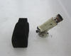
 New generator elbow.
 Jerry!
|
||||||||
| Tuesday August 14, 2012 |
Long Pond, NL
|
The big news today is that it's Susan Curtis' birthday!
Of secondary importance, Sean and Jerry managed to get the high output alternator with it's unusual external regulator wired together and installed, so maybe that problem is solved. |
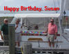 Happy birthday, Susan!
|
||||||||
| Monday August 13, 2012 |
Long Pond, NL
|
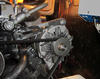
Boat repair this morning involved addressing the Northern Lights generator which had shut down twice. Also, we are still trying to get the high output alternator going.
Once the generator was examined, it was apparent that the exhaust elbow was defective and was the likely cause of the over heating trouble. A call to Bob Brandon at Tidewater Yacht Service in Baltimore brought about a hasty solution to the parts procurement. Bob and Kyle Marshall, TYS Parts Manager, arranged an airlift delivery into St. Johns, so we expect to have the generator fixed in the next couple days. Limmershin's local mechanic, Jerry Veitch, took the alternator away for a bench test, so we expect to hear of a solution in a day or two. |
 Generator repair.
|
||||||||
| Sunday August 12, 2012 |
Long Pond, NL
|
Having secured a rental car from the St. Johns Airport yesterday, we went into the city of St. Johns today. Our objective was to scout the wharfage situation in what had been (accurately) described to us as a busy working harbor without much room or patience for pleasure craft like Limmershin.
St. Johns has a young professional population and a vibrant nightlife that centers around George Street. Of course, we had to take George there. We ate lunch at Yellow Bellies, a pub in one of the older buildings in the waterfront neighborhood and then went up on Signal Hill for the view. In short, we were sightseeing tourists for the day.
|
 Royal Newfoundland Yacht Club hosts Limmershin.
 Entrance to St. Johns harbor.
|
||||||||
| Saturday August 11, 2012 |
Long Pond, NL
|
Limmershin is now at the wharf of the Royal Newfoundland Yacht Club. Long Pond in in Conception Bay, across the penninsula from St. Johns, the capital and biggest city in Newfoundland. So we are back to civilization.
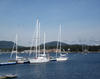
Yesterday we left Irelands Eye and decided to go the whole way here rather than stop in Old Perlican as originally planned. Since there is no place but the fishing wharf to tie up to in Old Perlican, and we were told that shrimp processing was going full tilt, we decided that a reprise of the Twillingate aroma therapy session was unnecessary. The best part of the day was finally seeing puffins in real life. These are small (~6 to 8 inches tall) birds that live along the rocks and shores and dive for fish. They are a quintessential Newfoundland sight, like moose, caribou, whales, and seals, but we have not seen any, for certain, up until today. Now, we have seen hundreds! The plan is to stay here and pick up Patrick and Jason at the airport next Wednesday, so we hope to get a rental car and do some land touring. |
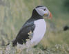 Puffins finally seen!
 Bell Island Ferry.
|
||||||||
| Thursday August 9, 2012 |
Irelands Eye, NL
|
Out of Bonavista, as usual, before dawn, Limmershin traveled into Trinity Bay destined for the island called Irelands Eye. Sean lives on Irelands Eye Lane outside of Oxford in Maryland, so, even if there was no other reason, we were compelled to look it up. The entire island population was relocated in the 1960's during one of the first big resettlement pushes, so there are no people permanently living there. Yet, there are two very scenic and terrific harbors that are perfect for a cruiser's stop.
The most accessible harbor is Traytown so we headed there and, after a careful squeeze, entered the old town's harbor. There was already another sailboat there but, with plenty of space, it was no problem (actually, it's so unusual to see other cruising sailboats up here that it can be a welcome sight). We toured the harbor by dingy, climbed up to where we thought the old church would have been, but found no sign whatever.
|
 Lighthouse on Cape Bonavista.
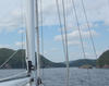 Entrance to Traytown harbor.
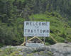 Welcome to Irelands Eye!
|
||||||||
| Wednesday August 8, 2012 |
Bonavista, NL
|
For the vast majority of our time here, the weather has been very cooperative, more often than not, sunny and cool with reasonable winds. Even the native Newfoundlanders are virtually unanimous in commenting on how unusually mild this summer has been. After some rain during our morning passage, today we encountered weather almost like we would find at home. The air temperature is around 80F but the humidity is very hign (dew point in the 70's) here in Bonavista.
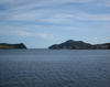
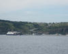
It was a ~40 nm trip across Bonavista Bay this morning that got us here and, once again, it was smart to leave early and arrive early. The afternoon winds arrived just as we were docking and it has been blustery since. Bonavista is an attractive place. The land here is relatively flat so there was room to grow after John Cabot (real neme: Giovanni Caboto) set foot here in 1497. He and his 18 crew didn't stay but his landing was recorded as the first and the town is still bragging today. Physically, the feel here is more that of a New England seaside village than a hard working Newfoundland fishing town.
|
 Bonavista approach.
 Limmershin at Bonavista's wharf.
 Crime is down in Bonavista.
|
||||||||
| Tuesday August 7, 2012 |
Wesleyville, NL
|
The ~50 nm trip from Seldom to Wesleyville went very fast! We were off the dock a little before 0600 and arrived at noon for a average speed of just about 8 knots. The winds were on the beam and Limmershin likes that.
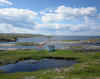
The passage around Cape Freels was not as exciting as that past Change Island, into Seldom, but did involve avoiding some rocks, ledges, and shoals. These, however, don't have the colorful names of Sunday's navigational triumph. "Stinking Banks" was pretty much it for colorful names today. Wesleyville is at the top of Bonavista Bay on the west side and is really just a stopover. We arrived early enough to walk into town, such as it is, and see it all (grocery, drug, liquor, hardware stores and the church and the museum) in 45 minutes. Limmershin is tied to a sheltered floating wharf, but there are no other amenities.
|
 Wesleyville approach.
 Newfoundland.
 Downtown Wesleyville.
|
||||||||
| Monday August 6, 2012 |
Seldom Cove on Fogo Island, NL
|
Some explanation is in order: This town is actually called "Seldom Come Bye" having been changed from it's oiginal name of "Seldom Go Bye" (the original name on Sir Charles Hamilton's chart) given because of the difficulty schooners had navigating south of Fogo Island. The community eventually changed the name to "Seldom Come Bye" because schooners seldom passed without coming in. Latter day lassitude has reduced the name to "Seldom". At least that's their story and they're sticking to it.
The storm passed far enough to the north of Fogo Island, that we saw only a brief bit of gusty wind and the day has turned out to tbe delightfully bright, sunny and dry. Sean and Bob hired a taxi for a tour around the island (George stayed behind, feeling the effects of a cold) and went to the town of Fogo on the north shore and to Joe Batts Arm, farther east. The island has ~2700 residents and successfully resisted resettlement back in 1968. The human population has been decreasing and aging with the demise of the fish population, but there is still ferry service several times a day. Most young people leave the island to find work elsewhere. Later this year, the Fogo Island Inn is scheduled to open. It is a ~30 room luxury resort hotel being erected by a wealthy computer entrepreneur, Zita Cobb, who was born in Joe Betts Arm. Ms. Cobb wants to cultivate artistic and cultural activities on the island, already having built studios in various locations for visiting artists. Many residents are skeptical, but glad to have the investment and attention, and are duly proud of their successful island daughter. |
 Downtown Fogo.
 Fire power at the Fogo harbor mouth.
 Joe Batts Arm is a town.
 F.U. Trading Co. store.
|
||||||||
| Sunday August 5, 2012 |
Seldom Cove on Fogo Island, NL
|
Not being sure when the gale might commence this afternoon, we exited Twillingate at dawn for the ~ 38 nm trip to Fogo Island. Although it is on the southern coast of the island, Seldom Cove looked like the best bet for shelter should a southwesterly wind start howling. The harbor has a lagoon going westward from the main part and around that corner is where the sheltered wharfage is found.
This was one of the most entertaining navigation exercises of the trip. For those of you following on your charts at home, Limmershin rounded Bacalhao Island and turned south down the western side of Change Island dodging such things as Blowhard and Kiar Rocks, Moorham Reef, Shag Rock, and Five Fathom Rock. Upon reaching Smoker Island, Limmershin passed Farewell Reef, Black Rock, Dog Reef, and Black Head Island before veering eastward at Cork Rock, past Indian Lookout and into Stag Harbour Tickle ("tickle" being an appropriate description of a tight passage!). Once that was over, it was an easy run into Seldom Cove. Our assessment of the shelter provided was right on and we are tied up at the F. U. Trading Co. wharf which is now a marina. (No, it's not what you are thinking...F.U. stands for "Fishermens Union".) The marina is quite nice, but has room for only two yachts and Limmershin and Ashataya have filled it to capacity. A passing fisherman gave Sean some fresh cod, so we will be dining on that tonight and plan to hire a taxi for a complete tour of the island tomorrow. |
 Red dawn means trouble?
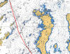 Limmershin's path to the Tickle.
 The wharf in Seldom Cove.
|
||||||||
| Saturday August 4, 2012 |
Twillingate, NL
|
A layover day here in Twillingate provided some rest and relaxation (but not a respite from the odor of the fish plant). The gale that was forecast has been postponed until Monday so we plan to go to Fogo Island tomorrow and find a place to hide.
We watched a little of the Olympics in the Harbor Master's lounge, seeing the exciting 10,000 meter run, and Sean and Bob took the dingy across the harbor to the Anchor Inn for dinner. Not a day filled with excitement. |
No worthwhile photos today!
|
||||||||
| Friday August 3, 2012 |
Twillingate, NL
|
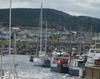
Once again, it was a pre-dawn wake up and shove off at first light, but we left Pacquet in relative tranquility with no fog and light winds. The distance to Twillingate is a very reasonable ~40 nm, so with a little help from favorable beam winds and no hinderance from foul current, we arrived shortly after noon.
The name alone suggests that Twillingate should be a classy place, but the wharf where we tied up, at the suggestion of the cruising guide, was jammed with fishing boats who evidently just finished cleaning their stores. This place has a huge, smelly fish aroma that grants an authenticity as a fish port, but also makes it hard to be complimentary about the surroundings. In short: it looks good but it stinks. Oh well, we will likely be here a day or two to wait out what may (or may not) be a gale. The crew is happy that the skipper has relaxed the schedule so we can catch up on other activities. This side of Newfoundland has turned out to be far less chilly and damp than anticipated. Evidently the Labrador curent is far enough off shore that it's effects are small (our water temperature is 60F, not the 30-40's we expected) and the southwesterlies, that were so pronounced in the Gulf of St Lawrence, are blocked by the land. The natives tell us this has been an extraordinarily mild year. Although the upper part of Newfoundland's northern penninsula is relatively flat, this lower part resembles the south coast with its steep bluffs and deep drop offs off shore. It's no wonder there are few roads to the outports here, too. It's the same as the south coast where it cost of road construction would be monstrous given the rugged terrain. From a geological point of view, this coast is wildly spectacular. The rocky cliffs, crags, folds, and fractures suggest some of the most violent upheaval and thrusting one can imagine. |
 Twillingate light.
 Twillingate rocks.
 Fishy wharf.
 Twillingate waterfront.
 Astahaya finds Limmershin.
|
||||||||
| Thursday August 2, 2012 |
Pacquet, NL
(No uplink available from this town)
|
Originally, we had planned to make for Fleur de Lys, a distance of 38 nm, but since we found no fog, flat seas, and a breeze from the southwest, the destination changed to Pacquet. It is about 15 nm east of Fleur de Lys, so it is "farther down the road" and, with the favorable conditions, an easy reach, and it makes tomorrow's trip to Twillingate shorter. So here we are.
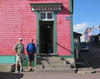
As with the GPS error in Englee, charting for the northern penninsula of Newfoundland is less than complete. We were lacking a chart for Fleur de Lys (because there is none), but the 2011 issue of the ATL 101 Canadian Sailing Directions has a nice newly minted detailed chart of Pacquet's harbor. So, again, advantage Pacquet. Pacquet is another of the many outport fishing villages undergoing big change. The road does reach the town, so it's not as isolated as some, and it is certainly much brighter, both in presentation and attitude, than most we have visited. We spoke to one young guy who is a miner in nearby Bay Verte, another who is a fisherman waiting to go out again for cold water shrinp (i.e. the small shrimp), and another back from Alberta, where so many have gone for work in the oil fields. so even though fishing is no longer king, there is still work to be had.
|
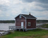
 Pacquet's on a rocky coast.
 A nice wharf in a nice town.
 Limmershin in Pacquet. |
||||||||
| Wednesday August 1, 2012 |
Englee, NL
(No uplink available from this town)
|
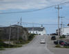
Making our way down the northern penninsula of Newfoundland, today we have arrived in Englee. It is about 52 nm from St. Anthony and we have been starting early and arriving early to beat the afternoon gales that so often pick up around here.
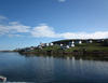
Today was rather dull since we sailed right into a fog bank leaving St. Anthony and didn't get out of it until we arrived at Englee and the wind was on the nose so we motored. Moving in past the headlands, the fog often abates and we saw some blue skies while docking at the government wharf. It's well sheltered and, so far, devoid of any harbor authority wanting to collect fees. We walked around town and found two "general stores" but no liquor store; a marine service center with a 150 ton travel lift looking a little tired, and some nice fishing village scenes. Tomorrow we move on.
|
 Englee approach. 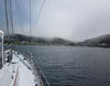 Looking for the Englee wharf.
|
||||||||
| Tuesday July 31, 2012 |
St Anthony, NL
|
Although the alternator was replaced in Port aux Chiox, it had not been operating properly. After trying various tests and finding no explanation or fix, Sean replaced the high output alternator with the standard 55 Amp unit that originaly came with the engine. This works fine to keep the batteries charged and the instruments running, but can't keep up with the demands of the refrigerator and freezer. Since we run the generator in the evenings and mornings, that will have to suffice to keep the freezer cool. It's not a huge problem just a minor day-to-day inconvenience.
There is a car rental agency here in St. Anthony with an interesting business plan...they have no cars. So we have been using Norman and his taxi for transportation and got him to take us out to L'Anse aux Meadows, about 30 miles north. This is where the Vikings established a settlement sometime around 1000 AD and stayed for only a few years. Archeology and the Norse sagas seem to fit together to confirm their presence, but a lot of questions remain about why they settled in that spot, why the left abruptly, what their goal was in coming in the first place, and so on. Parks Canada maintains the World Heritage site and we toured the excavations and saw the recreatons of the settlement. It was certainly worth the afternoon's visit. We also did some berry picking and spotted a moose who was also visiting the site.
|
 L'Anse aux Meadows
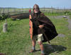 Viking.
 Actual site of L'Anse aux Meadows house. |
||||||||
| Monday July 30, 2012 |
St Anthony, NL
|
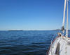
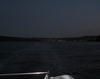
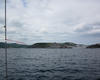
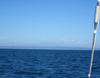
We arrived in St. Anthony about 1500 NDT after a ~52 nm trip leaving the Labrador coast. So we begin the return to the Chesapeake.
It was an early start so that we go down the Caribou Run exiting Battle Harbour by the "back door" and also getting beyong Belle Isle before the afternoon gales fired up. It went petty well. We had quite a bit of fog in the straits, enough to keep Belle Isle, itself, complately obscured while we passed a few miles offshore, but the sea state was well behaved and the wind came and went with no annoyingly large flare ups. We saw many whale and some porpoises in the colder waters of the Labrador current. We made good time, clearing the headlands of Newfoundlands northeastern tip, Cape Bauld, shortly after noon and enered St. Anthony harbor about 1500 NDT. It took some effort, but we eventually tied up at the government wharf among the big fishing boats by late afternoon.
|
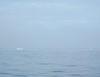
 Ice in Caribou Run.
 Close up of Caribou Run iceberg.
 Caribou Run. |
||||||||
| Sunday July 29, 2012 |
Battle Harbour, Labrador
|
With no cell or WiFi internet access in Battle Harbour, we took the morning ferry boat into St. Marys Harbour about 10 nm farther into St. Lewis Sound. The Historic Trust that manages Battle Harbour runs the ferry service and has wireless connectivity at their office in St. Marys, so off we went. It's about an hour's ride and then the ferry returns to Battle Harbour, so we had an hour to do computer stuff and tour the town.
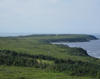
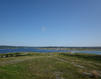
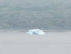
While enroute, we spotted an iceberg well within St. Lewis Sound near Caribou Run. It was accompanied by several fragments and growlers nearby, so we took some pictures from a safe distance. It's no surprise that Battle Harbour and, of course, the ferry close down for the winter in mid-September, but it is typical of the dramatic changes in this area where fishing was once king. From the mid-1800's through the 1960's, Battle Harbour was the commercial and political center of the Labrador coast. On shore communities came to Battle Harbour for supplies, trade, church services, health care, etc. Now those communities survive while Battle Harbour is an anachronism. Anyway, we returned to Battle Harbour in time for the Sunday Jigs Dinner at the General Store. Around here, "dinner' is the midday meal (i.e. "lunch") and "supper" is the late meal. A Jigs Dinner is traditional Newfoundland boiled fare that originated on the fishing schooners where everything (salt beef, potatoes, carrots, sauerkraut, peas pudding, yams, et.al.) is cooked in one big pot. It's traditional so we, as tourists, had to try it. It was good for a boiled meal. Then it was time for a walk up onto the hill behind the town. From the heights, the views of the sea to the east and the bay and landforms to the west are spectacular. Once again, we have been fortunate to have bright sunshine and blue skies when we want to be tourists so we saw a lot!
|
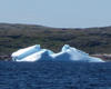 St. Lewis Sound iceberg.
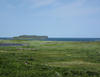
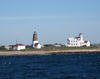
 Battle Harbour north
 Looking up St. Lewis Sound. |
||||||||
| Saturday July 28, 2012 |
Battle Harbour, Labrador
|
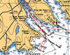
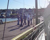
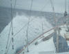
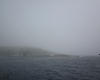
Limmershin has accomplished what she set out to do. The crew set foot in Labrador at Battle Harbour ~1430 NDT today. This was the ultimate destination we had planned when setting out and we made it before August 1. So far from what we see, it is better thAn expected. But the day's travel events were also exciting. We passed the Red Bay Harbour headlands on the way out at 0700 hours in low ceilings and some fog. The water was velvet calm and a chilly ~45F. The distance to Battle Harbour was not bad, about 52 nm. About half way we saw our first iceberg (see photos), then we saw more (see more photos). We never got close enough to get ice for cocktails, but, at one point we counted seven in view. Now, remember there was plenty of fog around so when going back into the fog bank, iceberg location was an item of interest. Next we saw what looked to some on the crew like a bunch of tuna jumping wildly out of the water about 200 meters (metric system in Canada, you know) away from Limmershin. Then whales seemed to be regularly spouting and doing whale-tail dives for us. It's too hard to get a photo, so it's just our word, but it was pretty cool. The fog lifted on and off, but enough to give us a good view of the Labrador coast and Belle Isle on the starboard side. Neither is populated to any degree. The view was frequently spectacular. Eventually reaching Battle Harbour, Limmershin had to go completely around to the north before entering the harbor. By then the wind picked up enough to produce some spectacular breakers on the sunken and not-so-sunken rocks. It provided an authentic feel for Labrador sailing. Upon arriving in Battle Harbour, we found the village jumping with a wedding in progress in the church on the hill. The couple and guests had arrived from Mary's Harbour by boat, most on a huge fishing trawler. We were met at the wharf by dozens of folks who helped us tie up to the only available dockside with good water.
|
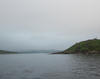 Leaving Red Bay.
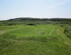
 Hello, Labrador!
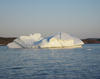
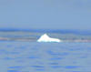 The biggest iceberg.
 The most icebergs. 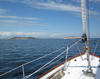 Battle Harbour approach. 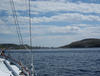 Closing in. |
||||||||
| Friday July 27, 2012 |
Red Bay, Labrador
|
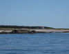
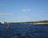
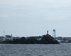
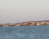
Limmershin made great time getting from Port aux Choix to Red Bay in a little over nine hours covering 72 nm. So we averaged 8 knots with the help of a following wind and favorable current. Red Bay is actually on the Labrador coast (as opposed to the Newfoundland site of the province) so it's our first stop in Labrador itself. When we arrived, however, the wind was blowing briskly and from exactly the wrong direction for us to use the only public wharf in town so we threw out the anchor and waited for the wind to die. It didn't die until late, so we never left the boat and, thus, haven't yet set foot in Labrador! Red Bay was originally used by Basque whalers at least as early as the 1500's and in that era is reputed to have been visited by ~1000 men and 20 ships during the season. Now it has ~150 residents, none of whom admit to whaling.
|
 Farewell Port aux Choix!
 Hello, Labrador!
 Red Bay approach.
|
||||||||
| Thursday July 26, 2012 |
Port au Choix, NL
|
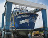
The new alternator and the transmission parts have all arrived and they are installed! Limmershin is revitalized, happy, and ready to go.
So with the favorable weather forecast for the next three days, we ought to be off early tomorrow bound for Labrador. The biggest variable in where we end up tomorrow night will be the effect of the current in the Straits of Belle Isle. The St. Lawrence Global Observatory has the only prediction model we have found and it shows the current turning against us after noon, possibly reaching speeds of 2 to 3 knots along the Labrador shore. However, our original itinerary has us in Battle Harbour on August 1st and, even if it take three more days, we will be right on time. |
 A new alternator.
|
||||||||
| Wednesday July 25, 2012 |
Port au Choix, NL
|
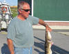
This is now "Family Cod Season" in this part of Newfoundland. Each person on board a boat can catch up to five cod with a limit of 15 cod per boat. No nets are allowed, only jigging is permitted. Jigging uses a hand line with baited hook, lowered to within a few feet of the bottom and jerking it up and down until a sufficiently annoyed cod chomps the hook.
When the weather allows, small boats with three on board head out and most seem able to catch their limit in a couple of hours. Yesterday the wind had died down enough that several boats went out including our wharf neighbor, Ralph O'Keefe's boat which his son Robin, with wife and young son ("the little feller") in tow, took. Ralph found out later. The Limmershin crew watched as they came back in and Ralph and Robin finished cleaning the cod. Ralph's other son, Kieran, had already supplied us with some fresh cod along with some frozen halibut. The cod will be dinner this evening. Otherwise, it is a day of waiting for parts. A few chores in town and then, with the loan of Ralph's truck, a trip to the liquor store in Port Saunders. |
 Sean and the cod.
 Ralph cleans the cod.
|
||||||||
| Tuesday July 24, 2012 |
Port au Choix, NL
|
We remain in Port aux Choix, but not all the news is bad. Sten came by this morning and he and Sean removed the coupling on the rear of the transmission so the leaky seal and the bearing could be examined. Since the threads on the coupling were badly scored, it was added to the list of parts to be delivered from the distribution center on Prince Edward Island. Sten thinks the parts will be here tomorrow or Thursday - about the time the alternator arrives from Texas.
With that attended to, Sten went over to Port Saunders to work on a 65 ft fishing trawler into which he, and his guys, are installing a 900 horsepower Mitsubishi diesel. Obvoiusly, that is a bigger project than our measly transmission repair, but Sten does seem to be following through for us. We were then free to go touring since Ralph O'Keefe lent us his truck for the afternoon. Port aux Choix has some history first as a place where archeological evidence shows aboriginal inhabitation going back some 4000 years. The Paleo-Eskimos, Maritime Archaic Indians, Amerindians, and Beotuks all lived here for varying length of time before Europeans arrived; at which time the Basques, French, and British vied for supremacy and settlement rights until the early 1800's. After that, Newfoundland muddled along as a colony/dominion of Great Britain until 1949, when Newfoundland joined Canada. Then there was more trouble...but that's a story for another day. So we went searching for history in Ralph's truck. The first stop was Point Riche National Park where the visitors center told of the various indian inhabitations, and we could travel out to the lighthouse that we passed coming into Point aux Choix. After lunch at the Anchor Cafe, it was off to Port Saunders which had been an alternative harbor to Port aux Choix since they are close by. The marine service center would have been one docking option so we went there. It is a really big deal fishing fleet service operation! And we saw Sten's project trawler, too. |
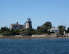
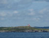
 Point Riche lighthouse.
 Sten's trawler project.  Canadian thoroughness. 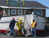 The Anchor Cafe. |
||||||||
| Monday July 23, 2012 |
Port au Choix, NL
|
It's now Monday and Sten, a local mechanic, who came highly recommended by the Coast Guard boys and the fishermen around the dock stopped by. He said he had a high output alternator at his shop but, alas, it turned out to be too big for Limmershin's mounting gear. As these things go, that alternator is no longer made, so we are having one fabricated in Texas and air freighted up here. They said this would only take a couple of days...we hope.
The leaky transmission seal, and what it means, is still uncertain. Some disassembly is still required to see how extensive the problem is. When we move on will depend on the transmission, alternator, and, also, the weather. NOAA's Ocean Prediction Center is forecasting a substantial low pressure system moving over the Straits of Belle Isle Wednesday and Thursday, so if we are staring at that tomorrow, we could be a few more days here in Port aux Choix. We have already found Newfoundland sailing is a game of slipping away to a secure port between nasty weather periods. It's impossible to completely escape some heavy weather sailing, but one would prefer to minimize it. |
 Iceberg report.  Moose meat chili for supper. |
||||||||
| Saturday July 21, 2012 |
Port au Choix, NL
|
Expecting relatively light winds early in the morning, we went for an early departure from Cow Head. But at first light it was really blowing and, to add to the dream, in a direction that was pinning us to the dock. Lesser seamen would have gone back to bed, but Sean managed to warp Limmershin way from the wall and make a frantic escape.
Once out beyond the rocks, we set a course for Port au Choix and found a 15-25 knot wind on our stern, creating lunpy seas and a generally uncomfortable motor sail. It looked bleak for a while but eventually things moderated and we plodded on to Port au Choix. It was almost 50 nm and we arrived near 1400 hours and found a good spot at the government wharf. Just to make it exciting though, we noticed some seepage from the transmission rear seal, encountered a generator failure, and saw that the alternator was not properly recharging the batteries. So once we were tied up, there were some repair tasks to attend to. Although Sean was able to diagnose and repair the generator, we will likely be here a few days so that the transmission and altenrator problems can be worked out. Once again, mechanical problems are to be expected and it's good to be in a decent port when dealing with them - especially when the guy on the next boat brings moose meat!
|
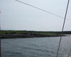 Ledges entering Port au Choix.
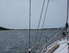 Port au Choix. 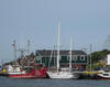 At the wharf in Port au Choix. |
||||||||
| Friday July 20, 2012 |
Cow Head, NL
|
Way too much wind this morning for Limmershin, and, futhermore, it was a head wind. So we stayed in port.
Last evening Scott Hutchings, a life long resident of Cow Head and a retired teacher, visited with us at the dock and, when he told us that there was no taxi service in town, offered to chauffer us around this morning. We took him up on the offer and he showed us all the sights from Cow Head to Shallow Harbor to St.Pauls to the bogs. We stopped at the museum, store, post office, the campground at Gros Morne Park, the Veterans Memorial, and his house. Later in the afternoon, Sean went to drop off the garbage and ended up walking to the end of Cow Head Island, finding the old lighthouse. Although we have lost another day to weather, we may actually arrive in Battle Harbor on, or even ahead of, schedule. Saturday and Sunday are likely to be good weather days so we expect to be in Flowers Cove Sunday afternoon. From there it's across the Belle Isle Strait to either L'Anse-au-Clair or Red Bay in Labrador on Monday.
|
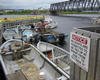 Fishermen in St. Pauls.
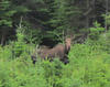 The moose is loose. 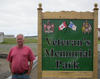 Scott's recent project. |
||||||||
| Thursday July 19, 2012 |
Cow Head, NL
|
We expected to remain in Rocky Harbour at least through today as the wind was supposed to blow hard and veer to north, which would be on the nose for us. However, we caught a break as things settled down nicely in the early afternoon, so we checked the current weather declarations from Environment Canada (the Canadian weather bureau) and they had no alarms to sound so we took off for the ~30 nm jaunt up to Cow Head.
In the morning, we called a taxi to get us to a propane refilling station and then hired the cab driver to give us a tour of the surroundings. While Rocky Harbour has its rugged beauty, the next towns farther in Bonne Bay proved to be very spectacular. Norris Point, which looked on the charts rather exposed to the nasty winds of yesterday, turned out to be a wonderfully scenic, and adequately sheltered, harbor. Neddie Harbor, a little further around the bend, would also have provided an acceptably protected anchorage and some beautiful scenery. Derek Pittman, our driver, said the area was a booming summer tourist mecca, but it didn't look that crowded to us although it certainly had all the scenery to be quite the attraction. The trip up the shore was uneventful except for the jog to the left to avoid Whaleback Rock, an ugly awash rock ambiguously shown on the cartoon graphics of the chart plotter. On the bright side, the sun came out and made the arrival in Cow Head very inspiring. We pulled in to the seltered wharf and found space with no trouble. A brief walk around the "summer village" on the island where the wharf is proved quite rustic. It looks like the prototypical postcard fishing village: a certain kind of sad beauty. The forecast for tomorrow is, once again, bleak so we may be here a day before the anticipated weekend break allowing us to go to Port aux Choix.
|
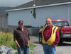 Sean & Derek in Rocky Harbour.
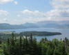 Seeing Norris Point from above. 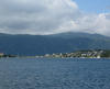 More Norris Point.  Gros Morne. |
||||||||
| Wednesday July 18, 2012 |
Rocky Harbour
in Bonne Bay.
|
This persistant low pressure system seems willing to stay until the weekend, but the forecasts have been good enough so far for us to find breaks. Today, we took advantage of one of those breaks.
A front approaching from the west was to increase the southerly wind over our part of St. Lawrence Bay during the morning, then in the afternoon, with the frontal passage, the wind would shift to westerly and blow hard for, perhaps, the next two days. So we were up and out of Little Port at 0530 hours hoping for Bonne Bay before things went downhill. The plan worked just fine. With mainly light following winds, (but plenty of mist and fog) we made excellent time and arrived in Bonne Bay before noon. Among the choices for tie up, we chose Rocky Harbor because it had a substantial government wharf deep within the harbor. When we arrived, however, the sheltered side was occupied with a number of small fishing boats. Asking on shore, we learned the name of the wharf master, got his home number from information, and called to ask if it was possible to rearrange the boats so Limmershin could be in a sheltered spot. Not only did he agree, but came directly down with his wife, the president of the Harbor Authority, and helped us move the boats. And he explained that the wharfage fee was $5.00 per day which included elecricity and water, so we are set. We have indeed seen high winds along with some very heavy rain, so we will be staying here at least for tomorrow and, maybe longer, until the storm finally passes. Went to dinner at Java Jacks Restaurant & Gallery just up from the wharf and had a delightful time. Good food served by personable and charming waitresses in an old house transformed into a restaurant. The owner, in this case Jacqueline, not Jack sat with us while we ate dessert and told about living in Rocky Harbour. Nearby is Gros Morne National Park, a spectacular area of glacially formed mountains overlooking the sea. We hope to get a look, but not having a car could be a serious drawback. The nearest car rental outfit is in Deer Lake, some 40 miles away. |
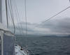 Gros Morne highlands. 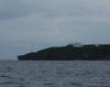 Rocky Harbour light. 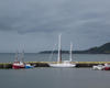 Limmershin hiding behind the Rocky Harbour wharf. |
||||||||
| Tuesday July 17, 2012 |
Little Port, NL
at the Bay of Islands
|
We were up at 0430 hours for a departure at first light figuring that the expected reasonable winds and moderate fog and rainfall would give us a chance to make the 92 nm jump to Bay of Islands and arrive in daylight. The winds have, indeed, been mostly favorable being from the stern and ~10 knots. We saw some heavy rain especially during the morning. But we needed to get moving.
We made excellent time and the wind remained light, even occasionally very calm. It was, however, Newfoundland weather. Low clouds, mist and fog stayed throughout. We arrived in Little Port, just outside the headlands of Bay of Islands about 1900 hours. The coast around Little Port is once again very vertical with bluffs and cliffs over 1000 feet above sea level and water depths of hundreds of feet just off shore. The mist and fog made for some spectacular sights. When we arrived in Little Port, there was plenty of room at the wharf, but that may have been because the wharf was being repaired and rebuilt. We tied up in a well protected spot but could not get to shore without laaunching the dingy. So we stayed onboard, it had been a long day anyway.
|
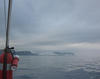 Newfoundland weather.
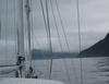 Approaching the entrance to Little Port. |
||||||||
| Monday July 16, 2012 |
Codroy, NL
|
As the forecast promised, the winds are piping in the 15-25 knot range as a broad disheveled low pressure system ambles through the Maritimes. So we are staying here today with a plan to leave at first light tomorrow, striking out for Bay of Islands some 92 nm away. It's appears to be the best weather window until the weekend, so we hope we can knock off the biggest leg of the west coast itinerary tomorrow.
The highlight of the day was a trip to the fish plant on our wharf where we bought some lobster, cod tails, and salt cod. We made some lobster salad with the first batch and have plenty in the freezer for the days ahead. |
 It was a nasty day.
 Rainy day chow. |
||||||||
| Sunday July 15, 2012 |
Codroy, NL
|
With a nice weather day expected, we left for the west coast of Newfoundland palnning to land in Codroy only about 30 nm away. There aren't many choices along the southern part of that coast. The first leg is a short one (to Codroy) and then the next leg is a long one of ~72 nm to Beach Point. It's too much to bite off the whole thing in one day and there is really no other way to split it up.
The wind was quite light and, what little there was, was from the stern so it was an easy trip to Codroy. Upon arrival, we learned that today is the last day in the annual Codroy Seafest, a seafood festival so we are hoping for some good eating this evening. The forecast for tomorrow is for 20 - 25 knot winds which may keep us here if it looks like it could develop further. We won't know if we are leaving until the morning.
|
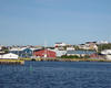 Leaving Port aux Basques.
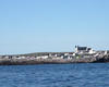 Port aux Basques looks better from here. |
||||||||
| Saturday July 14, 2012 |
Port aux Basques
|
It's raining and a bit chilly, but we had planned to stay here today anyway.
As a side note, we are 1700 nm into this trip and we are one of three sailboats in Port aux Basques, two are from Oxford, Maryland. Egret just arrived this morning. The crew was wet. The rain did stop early in the afternoon and clearing followed. It turned out to be a pretty nice day later on. After cocktails with Jon and Dorothy from Egret, during which we heard about their adventures especially in Gray River, the Limmershin boys went up the hill to the St. Christphers Hotel for some Fisherman's Brewis (Sean had a burger). |
No photos today.
|
||||||||
| Friday July 13, 2012 |
Port aux Basques
|
The forecast yesterday had us thinking we might be spending a day in Rose Blanche, but by late morning it looked promising enough to make a try for Port aux Basques. It was only about 20 nm, but with the developing wind, on the nose, of course, it was all we wanted for that day. It was a slow slog, but we made it just fine by early afternoon.
The public wharf is large and almost completely unoccupied. We are parked near the ferry that goes to Sydney in Cape Breton and will stay over tomorrow getting organized for the trek up the west coast to the Belle Isle Straits.
|
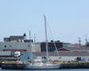 Limmershin in Port aux Basques. 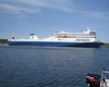 The ferry from Port aux Basques to Sydney. |
||||||||
| Thursday July 12, 2012 |
Rose Blanche (after a stop in Grand Bruit)
|
The outport community, Grand Bruit, was our intended destination and we did, indeed, go there. Grand Bruit is one of the scattered villages on the south coast of Newfoundland to which there are no roads, it was serviced by ferry. It was closed by the Canadian government in 2010, meaning that the remaining residents (rumored to have been ~12-15) voted unanimously to accept a buy out and leave. The government then no longer needed to supply ferry service, schools, subsidy for electric and other infrastructure, periodic visits by a medical person, and helicopter ambulance service. With the virtually complete demise of the fishing, there is no economy whatever in these outports. Several other have been closed. Grand Bruit was the nicest of the outports I had visited and the last I would have expected to be shut down.
There were no people at all when we arrived and no boats anywhere in the harbor. We tied up at the ferry dock, which is still quite solid, and walked around town. The church was open but quite empty. There was a guest book which we signed and noted that several other had signed in this year, including the Egret crew the day before. (Egret is the other sailboat from Oxford that we have run into up here.) We had originally thought of staying for the night, but it was too sad and depressing to be in the abandoned settlement, so we set off for Rose Blanche. Rose Blanche is the last small town east of Port aux Basques connected by road, but it is still small and beset with the same troubles as the outport fishing villages, i.e. the fishing is gone. We tied up at the substantial government wharf and, since there is no real business in town, we ate on board.
|
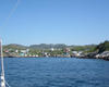 Arriving in Grand Bruit.
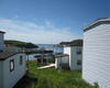 Sad sight in Grand Bruit.
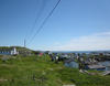 Grand Bruit' church and firehouse on the hill.
|
||||||||
| Wednesday July 11, 2012 |
Burgeo, NL (Newfoundland)
|
Francois was terrific, but we had to move on. Today's plan was to travel out to the Ramea Islands, which are about 5 nm off the coast and has a significant settlement called Ships Cove. It was only about 18 nm from Francois Bay and the guides warned about exposure to nasty winds if one were to stay overnight, so we did a drive by to see the place.
As the bright, sunny weather pattern continues to hold, we are definitely seeing all of the sights (as opposed to passing them in fog), but the down side is that we have had a brisk wind on the nose virtually throughout. Fortunately, Limmershin has a powerful engine (and a fine, sturdy transmission) so we have been doing a lot of motor slogging. The strategy is to get started early, when the winds are light or, at least, lighter. So if the wind gets tiresome, we can stop before too late in the day and still have covered some distance. Burgeo was today' planned destination and we reached the islands about 1330 NDT (Newfoundland Daylight Time). This is a complicated collection of islands, rocks, and shoals with a wharf neatly tucked into a tiny passage. The chart looks like something a pirate would have used to hide his treasure, it is a reproduction of the British Admiralty Survey of 1879. Excellent visibility enabled us to negotiate the entry without a problem, although entering between two rocks one boat length apart, and other submerged rocks nearby, was not unexciting. Burgeo is the only town with a road running to it from Harbour Breton to the east to Port aux Basque on the southwest tip of Newfoundland, a distance of ~125 nm. Once secured at the wharf, we walked around the spread out settlement, finding the grocery, liquor, and hardware store. After helping Remedios, a Hinckley 57, tie up alongside and having a few cocktails with the crew, we went to eat at Joy's Cafe. The Moose Soup, Moose Burger, Partridge Soup, and Fish and Chips were good!
|
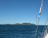 The Ramea Islands. 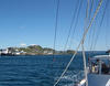 Past the village on the Ramea Islands. 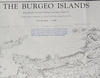 The chart for Burgeo. |
||||||||
| Tuesday July 10, 2012 |
Francois, NL (Newfoundland)
|
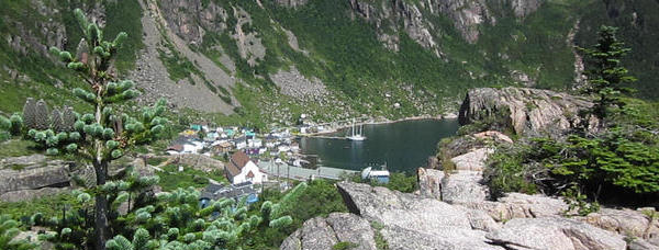 The updates to this trip log will probably become more sporatic now that we have gone off the radar screen in the wilds of Newfoundland. Labrador will probably be worse. The morning came with delightfully bright blue skies and low humidity. We have been quite fortunate to have excellent weather for seeing the sights given that this region averages 15 to 25 days of fog during the month of July. Today turned out to be another unbeatable weather day - except for the wind on the nose. Leaving McCallum, we were out of the harbor by 0800 hours, but the normally early calm had already given away to a westerly/southwesterly breeze. Naturally, that was our intended driection of travel, so we were motoring almost directly upwind. Every sailor knows this is a natural order of things when voyaging, so we plowed along. Limmershin is a pretty heavy boat and does reasonably well slogging, but it is slogging, nevertheless. Francois (pronounced "France-way", hereabouts) is a good destination because it is a scenic outport not very far from the ocean and thus, easy to get into and out of. Since it was only ~25 nm down the road, we were considering stopping only for lunch and continuing on, but, between the scenery and the choice to continued pounding into the wind and seas, we stayed over. It was a really good choice. If it were not so clear and bright, it might have been different, but the town and surrounding towering bluffs and deep green seawater provided so many more wonderful sights than we would have seen by going farther along on the sea. Once again, it's really hard to describe how attractive it is here today, so perhaps the pictures can help.
|
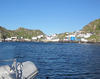 Leaving McCallum 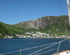 Arriving at the village of Francois. 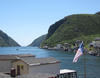 Looking back to sea from Francois. |
||||||||
| Monday July 9, 2012 |
McCallum, NL (Newfoundland)
|
The front passed on time and we left Harbour Breton with blue skies and sunshine - an unusual occurance for Newfoundland this time of year. We were bound for McCallum, a true outport with no roads, only ferry service, but had bail out positions in case the weather turned on us. Although there was sunshine, that can mean that the westerly winds behind a front can be pretty stiff.
Headed out Fortune Bay, we rounded Pass Island into Hermatage Bay. Although some clouds appeared, they parted by the time we got to Little Passage and we turned up the passage in splendid bright sun and blue skies, once again. This turned out to be one of the most stunning six miles we have ever traveled on a sailboat. It's a fairly narrow pasage with high bluffs sporting green slopes and waterfalls every half mile or so. We saw a whale broach and a bald eagle soar. The scenery was beyond description, maybe the photos will help. Since we were making good time, it was on to McCallum for the days final docking. This a scenic place but also a troubled place. With the demise of the cod, so many of these old outports are on hard times and the Canadian federal government wants to close them down so they don't have to provide services like schools, ferry service, diesel generators, health centers, etc. to the few (typically less than 60) residents remaining. |
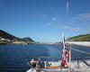 Leaving Harbour Breton on a beautiful morning.
 The skipper rounds Crow Head. 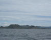 Around PassIsland. |
||||||||
| Sunday July 8, 2012 |
Harbor Breton, NL (Newfoundland)
|
With a slow moving broad low pressure system keeping plenty of mist and fog across the land, we waited until mid-morning to move out from Fortune. But the delay gave us the opportunity to explore the fishing operations on the wharf. We found the boys unloading welks, which are fairly large snails - the kind with the helical shell one often sees in souviner shops. They catch them in traps that look like minature snow crab traps.
The passage to Harbor Breton was uneventful. The fog lifted a few hundred feet above the ground and we had quite good visibility most of the time. One really good whale sighting occurred about half way there as we neared Sagona Island (for those following us on their home charts or Google Earth). Harbor Breton is one of the more populated ports in this part of Newfoundland and has roads that lead to it. They claim a population of ~2000, but it looks bigger. We tied up at a dock that we learned was the city dock when the Town Supervisor, Parker Strowman, helped us secure the lines. Once again, we find that the wharfage is free. Afterward, we walked around the (pretty spread out) town, ending up at the Hook and Reel for a ritual shot of Screech - a Newfoundland rum also used to start snowmobiles of frigid mornings. One of the crew actually had two.
|
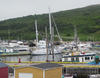 A real wharf for Limmershin.
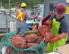 Unloading snails on the Fortune waterfront. |
||||||||
| Saturday July 7, 2012 |
Fortune, NL (Newfoundland)
|
Limmershin made the ~25 nm crossing from St. Pierre to Newfoundland, arriving at Fortune for a visit from Canadian Customs.
We left about 1100 hours since the morning fog was quite impressive. The trip was uneventful and we arrived about 1600 hours. The "about" part is a result of the unusual time zone changes here. Nova Scotia is on Atlantic Daylight Time, St. Pierre is on Atlantic Standard Time, and Newfoundland is on Newfoundland Crazy Time which is one half hour ahead of Atlantic Standard Time. We have yet to reconcile the satellite phone schedule with George's wrist digital watch which he can't figure out how to change, so he is on George NonStandard Time...got all that? The Canadian Customs guys actually boarded Limmershim after we tried to check in by phone, as we had done when initially arriving in Canada. They decided that we had exceeded our allowance of 40 oz of alcohol per person because of a stockpile of wine boxes, and charged Sean $55 in penalty. Some on board think the customs guys were so flaggergasted that a vessel would come from France with boxed wine on board that they had to take a stand.
|
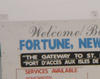 Welcome to Fortune.
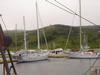 Tied up waiting for Canadian Customs to visit.
|
||||||||
| Friday July 6, 2012 |
St. Pierre, France
|
Big winds and rain today kept us in port, but also because David was to catch a plane this afternoon to go home.
Otherwise, we went shopping for provisions, then to lunch, a museum, and to dinner after waiting out a big blow and hefty rain. Maybe leaving for Fortune in Newfoundland tomorrow if the storm weakens. We hear it is very hot back home, but that's why we are here! |
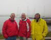 How hot is it in Maryland today?
|
||||||||
| Thursday July 5, 2012 |
St. Pierre, France
|
In town, we visited the boulangarie for pasteries and generally wandered about to see the sights. Of course, we looked for tee shirts and various other geegaws that would be typical of St. Pierre. Then, it was lunch at the Restaurant l'Escale (seafood salad and esoteric pizza) and French beer.
A few boat chores (oil change, autohelm oil addition) and then, at cocktail hour, we invited the couple on the Beneteau 47 docked next to Limmershin to share our hors d'ouvres and fancy wine. They came in from the Madeleine Islands (in the Gulf of St. Lawrence) the same day as Limmershin and, in fact, we passed them in the fog between 0130 and 0300 hours, seeing them only on radar. Later that morning, their motor quit because of a fuel leak, so they had to be towed in by the St. Pierre Coast Guard. |
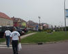 Place du General de Gaulle.
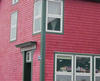 Where to get cheese and sausage.
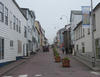 Rue Francais Libre in St. Pierre.
|
||||||||
| Wednesday July 4, 2012 |
St. Pierre, France
|
The departure from Baddeck went smoothly. To exit the Bras d'Or, we were to pass through an ~20 nm channel going north to the Laurentian Channel for the crossing to St. Pierre. We waited until mid-morning for a favorable current, so most of the crew went into town before leaving. It was very sunny and clear blue skies when we left - wouldn't be for long.
While passing under the Seal Island Bridge, we could see fog ahead and it would bring visibility down to, at best, a few hundred yards and, at times, zero for the next 24 hours. Sailing in the fog, especially at night, it's comforting to have a good radar unit and a low traffic density, both of which we had. About seven miles from Miquelon, the fog lifted enough for us to sight land, and continued to improve, making harbor entry straightforward. We cleared customs and immigration, had cocktails and went to town for a very good French dinner at Ls Rustique.
|
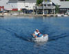 Limmershin's press gang at work.
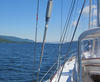 Leaving the Bras d'Or, headed for the sea and St. Pierre.
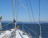 Entering the fog bank.
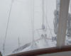 In the fog bank.
|
||||||||
| Monday July 2, 2012 |
Baddeck, NS
|
We stayed over in Baddeck today, waiting for a frontal passage and it did, indeed, arrive this afternoon, finally passing around 1800 hours.
Earlier, we went ashore in the dingy and went to the Alexander Graham Bell Museum. After his invention of the telephone, he, quite understandably, grew weary of the Washington, DC, summer heat and relocated to Baddeck. He acquired a sizable estate just outside town and spend decades working on various other ideas. We beat the rain back to the boat after lunch and a few other syops in town. We expect a good weather window tomorrow and Wednesday for the St. Pierre overnight crossing. |
 Moved to anchor from the mooring.
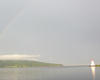 Rainbow after the storm.
|
||||||||
| Sunday July 1, 2012 Canada Day |
Baddeck, NS
|
(Connection trouble delayed this posting.)
So the transmission is working! We left St. Peters this morning at 0830 and arrived in Baddeck at 1230 hours, motoring the entire way with no hiccups from the newly repaired and installed transmission. The weather couldn't have been better for a motoring trip. Bright sun, blue sky, light wind and flat water gave us a good opportunity to test the transmission and it passed very satisfactorily. The scenery out of St. Peters is some of the nicest on the whole trip so having excellent visibility was a big plus. After passing through the Barra Straits separating the Bras d'Or Lake from the Great Bras d'Or, it was on to Baddeck and a mooring. This being Canada Day, there was a good crowd in town but not so crowded that couldn't find space. We took the dingy to town in time to buy some raffle tickets for 40 lb of lobster (we didn't win), stroll up the main street, and see the parade - kind of like the Catonsvile July 4th parade only smaller. George and David wanted to see some goofy soccer game on television, so we went to the yacht club bar. Sean and Bob spent the time out on the deck (where the view is wonderful) and, in a small world story, met a co-worker of Newfoundland Bob, who we met and ate dinner with in Liscomb. Both guys are from Newfoundland, now living in Nova Scotia, and are retired from the coastal ferry fleet that serves Newfoundland and Labrador, and are delightful story tellers. Back to the boat for cocktails, pasta, and fireworks. Our spot in th eharbor was a perfect spot for watching. A front coming this way will keep us here tomorrow. We plan to leave for the 202 nm crossing of the Laurentian Trough to St. Pierre on Tuesday morning, expecting to arrive at the customs dock around 1700 hours. |
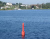 Leaving St. Peters.
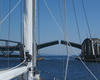 Barra Strait.
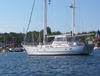 In Baddeck on a mooring.
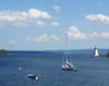 Baddeck harbor from the YC deck.
 Canada Day parade.
|
||||||||
| Saturday June 30, 2012 |
St. Peters, NS
|
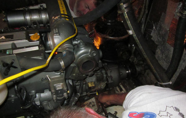 The transmission is back and installed! The repaired transmission was delivered at 1230 hours to the dock and we were very happy to see it! After loading it onto Limmershin, beng careful not to drop it in the sea, the four crew managed to lug it down below without dropping it or rupturing any discs. We figured it weighs around 150 lbs. Working in the cramped engine compartment, Sean and David were the primary wrench wielders, with George and Bob backing them up. Harold Landry and his son George, whose company, General Propulsion did the rebuild, were on hand for advice, but Sean and the crew did the install. At 1630 hours, the last connection was made and shortly thereafter, we went for a test drive around the harbor area. Everything seems fine. But, of course, tomorrow when we leave for Baddeck, ~30 nm up the Lakes, it will be the real test. For now, it looks good! |
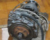 Arriving below deck. 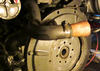 Drive plate in place. 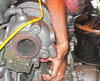 Cramped space. 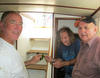 The transmission brain trust. |
||||||||
| Friday June 29, 2012 |
St. Peters, NS
|
David and George delivered Justin to the airport in Sydney, on the north end of Cape Breton about 45 miles away, in time to catch 0900 hours flight.
The news from the machine shop continues to be "it's coming along", but it's not here yet. Maybe tomorrow. There is no point in fretting too much since we really have no alternative but to be patient and see how it works out. After lunch at Chubby's, we went over to River Bourgeois after hearing that Harold and several other folks we met live there, and it looked interesting on the charts. It really is a great spot, maybe my new favorite fanatasy vacation home location! The community of River Bourgeois is spread out along the shores of a series of interconnected inlets. It has green lawns and fields, nicely spaced and maintained houses, with a stately white church in the highest point.
|
 Chubby's Lunch.
|
||||||||
| Thursday June 28, 2012 |
St. Peters, NS
|
Both Harold and Gerry Gibson, the marina manager, told us they thought the transmission might be delivered late this afternoon. We were initially optimistic, but doubtful. It would be a big plus if it shows up before the weekend since Sunday, July 1, is Canada Day, the equivalent of our July 4th, and it's a long holiday weekend here. Were we to get it, we ought to be able to install it over the weekend and move on by Monday. But, that's not tp be. No transmission today.
So, this gives us time to tour around the village a little more and we headed for the ocean view trail. As the name says, it is a walk way along the shore line that defines St. Peters southern extent. The trail follows the bed of the long gone railroad and allows for fine views of the bay across which we traveled to get here. Before arriving at the trail, however, we stopped in at the MacAskell House Museum. Wallace MacAskell was a locally famous photographer, from St. Peters, who worked mainly out of Halifax from the late 1890's until the 1950's. The house was his childhod home, built in the mid 19th century, and was a nice example of housing from that era. Most of his well known work showed sailing vessels and other nautical elements, so that was interesting to us sailors. The ocean front trail ends at the canal, so it was another chance to see it, but without the excitment of pulling an 88,000 lb ferrocement ketch through it with a dingy and an 8 hp outboard. Justin leaves early tomorrow, so we went looking for some fresh seafood and came up with ten frozen Atlantic Snow Crabs. These are the eastern equivalent of the Alaskan King Crabs are are caught by local fishermen. It was quite a feast.
|
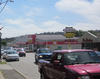 Downtown St. Peters.
 MacAskell House.
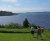 Heading for the ocean view trail.
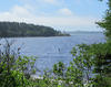 Point Jerome from the trail.
|
||||||||
| Wednesday June 27, 2012 |
St. Peters, NS
|
Sean, David, and Justin went for a tour of the Cabot Trail this morning. George and Bob had enough road tripping yesterday, so remain in St. Peters.
Harold stopped by with news that the coupling on the transmission needed to be machined to repair a stripped and damaged thread attachment and probably won't be ready until after the weekend. Bad news that we could well be stuck until next week, but good news in that the transmission could be fixed. The Cabot Trail crew made great time getting to the other end of the island to begin the counterclockwise route. Counterclockwise so that the pull offs would be on the ocean side for a better view. Fog was the issue and there was some at the start. The cable ferry at Englishtown took the rental car across St. Anns Bay on the first leg of the trek. This is the scenic way to go. Fortunately in short order, the fog began to lift and was no longer a real problem. So on to Ingonish, Neils Harbor, and Dingwall. Ingonish has the Keltic Lodge, a fancy inn and golf resort, while Neils Harbor is just the opposite, a hard working fishing port where the boys were ending their lobster season. Beyond that, they stopped in Dingwall and scouted out a servicable harbor in the event that Limmershin traverses the Cabot Straits. After a delicious lunch at a small restaurant whose name they couldn't remember, the Cabot Trail contingent of Limmershin's crew bypassed the turn off to Meat Cove, which is at the extreme top of Cape Breton. Sadly, no one could tell us why it's named Meat Cove since there must be a good story there. Heading across to the Gulf of St Lawrence side of the island, a turn off took the boys to the waterfall on the North Aspy River - a most spectacular sight. The last significant stop was at the Glenora Distillery. It is the only distillery of single malt Scotch whiskey in all of Canada! What a break that we should stumble across it!
|
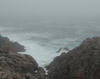 Cabot Trail tour begins in fog.
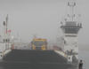 Englishtown ferry.
 Awaiting the Englishtown ferry.
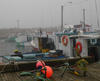 Neils Harbor.
|
||||||||
| Tuesday June 26, 2012 |
St. Peters, NS
|
With the transmission delivered to Halifax, we were left to our own devices for entertainment here in St. Peters. Certainly a mechanical breakdown is not a happy event, but, given the weather situation (gale force winds, heavy rain, wild seas), we weren't going anywhere today anyway. So, from a positive perspective, we are combining two layover problems into one layover day in one of the best spots to be stuck. The marina is first class and the village has everything we need to resupply.
As I had done on previous visits, we arranged a rental car from National in Port Hawkesbury, about 20 miles away by land. They provide transportation for pick up and drop off for a reasonable charge, so David and I set off to get some wheels. The biggest car they had was "full size", but it was a Hyundai Sonata. Now, with five strapping sailors (the largest being 280 lb Justin), this became a good imitation of the Clown Car from the circus. Justin had to ride in the front and David was the designated driver, so Sean, George, and I were crammed into the back seat when we took off for a tour of the southeastern coast of Cape Breton bound for the French fortification at Louisbourg. We stopped at Chapel Cove to look at the harbor and wharf, at Mombourquette to check on the snow crab and lobster fishermen mending their gear, and then at Point Michaud Beach where there were no bathers (and probably hadn't been since the continents split apart). When told that we were heading, Sean and George were that we would see plenty of trees and that was accurate. For the next 1½ hours that's all we saw as we wound through some scruffy barely populated forest land. We arrrived at the Fortress in Louisbourg just after 1600 hours, burst forth from the Clown Car to find that the fort closed at 1700. But that worked out fine since they don't charge admission during that last hour and we saw all the recreation and reenactment we needed. The fort was the center of the French presence in the Maritimes during the era of contention bewteen France and England (War of Austrian Succession, 1740's, and the Seven Years War (French and Indian War) in the 1750's, after which it was finally destroyed by the British leaving Halifax as the military and political center of Nova Scotia. So we got a dose of history. Reloading the Clown Car, it was off to Malagawatch and the Cape Breton Smoke House for dinner. Sandy and I had visited there in 2002 at the recommendation of some locals only to be less than thrilled and mystified by the lack of clientele. Leading up to this trip, George came across a recommendation for the place, so it seemed worth another try. We arrived in a driving rain at 2000 hours, pleased to find it was open, and amused by being the only customers in the impressive, large log building. The food turned out to be quite good this time. So, we will be here for a couple of days and expect to tour Cape Breton by rental car.
|
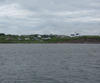 Visit to Chapel Cove.
 Mending snow crab traps.
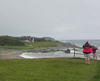 Scenic beach.
 Bob is happy!
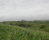 Fortress at Louisbourg. |
||||||||
| Monday June 25, 2012 |
St. Peters, NS
|
So the good news is that the morning arrived with sunshine and blue skies so we could move out of Canso across the Chedabucto Bay. The bad news is that while motoring across the dreaded Canso Ledges, the engine failed. Now, this got our attention real fast. But being a sailing vessel we had options. Sean asked Justin to get the sails out and he did ... in a hurry.
So we were under sail in light air, but got clear of the ledges and pointed toward St. Peters Bay and the canal. There was enough wind to keep us moving forward at 2 to 4 knots, and it is only an ~18 nm crossing so we were moving along. During the crossing, Sean figured that it was the transmission that was the problem. When approaching the canal, we had to dodge a few obsticles (like Samson Shoal) and the wind died. So we deployed George in the dingy along side Limmershin and continued toward the canal. The canal guys were very helpful getting us through the locks and George drove the propulsion dingy, with Limmershin attached, around to the fuel dock at the St. Peters Marina. But what do we do with the broken transmission? Bob having been here before, told Sean that Gerry Gibson at the St. Peters marina had all the contacts we needed to get help. And who shows up, but Harold Landry, at 78 years old, still the best marine engineer on Cape Breton. For the next few hours, Harold and Sean actually removed the transmission, the whole gang of us (after watching the surgery from a distance) hauled it on deck and then onto the dock and then into Harold's trunk for transport to Halifax for diagnosis and, probably, a rebuild. So, we will be here for a couple of days and expect to tour Cape Breton by rental car.
|
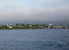 Canso departure.
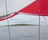 Past Green Island under sail.
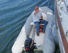 George towing Limmershin with the dingy!
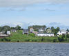 St. Peters from the sea.
|
||||||||
| Sunday June 24, 2012 |
Canso, NS
|
Heavy rain moved in overnight and continued on and off into the morning. Initially, we had hoped the front would pass early in the afternoon and let us make the 20 nm transit across Chedabucto Bay to the St. Peters Canal and on to St. Peters Marina. Well, the rain did abate but immediately the fog socked us in.
To pass the time, we went for a walk around Canso (in foul weather gear) and found some signs of improvement since I was last through here eight years ago. The reataurant is now reopened (we stopped in for a beer), the fish plant showed signs of activity, and a new government wharf had recently been completed. We were hoping the lobster fisherman showed again when we commited to another evening in Canso, and he did! George negotiated the purchase and David volunteered to make lobster chowder. While the weather showed some signs of improvement, it never did. However, the excitment for the evening was not over. After watching the first half hour of the movie Appapoosa, Bob, in the spirit of the classic western, commenced to bleeding profusely from the ankle. The cause was never determined, but with expert medical attention from Justin, a real EMT, the crisis subsided.
|
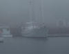 Not good sailing weather.
 Canso's new government wharf.
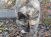 Wildlife in Canso. |
||||||||
| Saturday June 23, 2012 |
Canso, NS
|
Relaxed morning departure, after we paid our wharfage ($40 per night), showered at the pool house, and checked the weather, we were out by 0900 hours. We cut Newfoundland Bob loose and waved goodbye heading out into a cloudy damp morning.
This was the first day of real Nova Scotia sailing weather. Although the fog never thickened to the point of obscurity, it was a day of low clouds, wind on the beam, and chilly damp air. The water temperature was 55F and the air temperature was 57F. These are normal conditions for this part of the world at this time of year, but we had been lucky so far. We saw quite a few whale spoutings and the whales themselves gamboling in the waters. At 1600 hrs, we turned into Andrew Passage, a notorious span on Infrared's last voyage up here, where we found some new buoyage which was cause for some concern since there are serious rocks very nearby. But no problems. We pulled into the Canso marina about 1745 hrs to find that most of the docks hadn't yet been deployed and the overall size of the marina a little cramped for Limmershin. Sean did a masterful job of backing into a slip with the help of the marina boys among whom was a local lobster fisherman with a fresh catch. George negotiated our way into five live lobsters for less than $40, so we had dinner in hand. David cooked them up and it was great! Canso (the oldest continuously populated settlement in Nova Scotia) is still on hard times. Once a huge long line fishing center, Canso has been very depressed since the 1992 Canadian fishing moratorium. I did seem a little more lively than my last visit 8 years ago, but the folks still express a depressed outlook for the community. With some adverse weather forecast for tomorrow, we will wait until the morning to decide whether we will get to St. Peters in the Bras d'Ors Lakes or not.
|
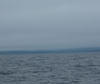 Real Nova Scotia weather.  Andrew Passage. 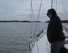 Justin looking ahead in Andrew Passage. 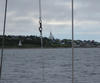 Approaching Canso. |
||||||||
| Friday June 22, 2012 |
Liscomb Mills, NS
|
The morning brought clouds and a bit of mist, but no fog, to Sallys Cove. We raised the anchor and were making our way out by 0730.
This part of the Nova Scotia coast is very sparsely populated and dotted with many islands that provide an inside passage. Since it's fun to sail among the obstacles and more scenic, we went inside past Pumpkin and Beaver Islands, past Halibut and Long Islands, toward Tuffin Island turning toward The Nightcap. At that point, we could head up into Liscomb Harbor. Liscomb Lodge is a fine stop over albeit about four miles off the highway. This is a lodge run by the Province of Nova Scotia and has a floating dock that fits two medium sized boats. Since I had been here beforoe, I called ahead and found that the dock master, Chester Rudolph, who was so accommodating before was still on the job, and he claimed to remember Infrared. So Limmershin was greeted at the lodge around 1430 hours and we occupied the entire dock until another sail boat showed up at 1730 hours. For a wharfage of $40 per night, we get shore power, water, onshore rest rooms and showers, ice, reasonably priced laundry, use of the pool, health club and spa. Compare that to Newport Yachting Center where for $5.00 per foot per night ($275 per night for Limmershin), you get power, water and filthy rest rooms. The dining room speciality is "planked salmon" which is salmon cooked the traditional Indian way. The salmon is tacked to a cedar plank, coated with maple syrup and butter, and placed vertically near on open fire for cooking. We set up reservations. However, when we got to the dining room, our waitress told us that the salmon was cooked yesterday - not good. We ordered other stuff. Late in the day, another boat came in and since the dock really couldn't fit both of us, Sean offered to let them raft up to Limmershin. Her skipper, another Bob (Bob Sherman on Moira Lawton out of Halifax), joined us for dinner and beverages.
|
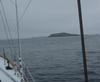 Pumpkin Island. 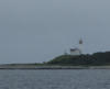 Beaver Island Light. 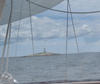 Egg Island light. 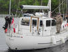 Company at the dock. |
||||||||
| Thursday June 21, 2012 |
Sallys Cove, NS
|
We left Halifax after returning the rental car and were at sea at 0900 hrs this morning. Finally, we had a positively excellent day of pure Nova Scotia sailing. Sunshine, no fog, offshore winds 12-18 knots made for near perfect conditions. Limmershin was making 6-8.5 knots so the ~50 nm passage to Sallys Cove went quickly.
This part of the coast lends itself to the "inshore" route for sailing vessels where it's possible to remain inside the islands, rocks, and shoals and stay protected from ocean swells. It's very scenic and exciting to navigate under sail the various (very haqrd rocky) obstacles along the way. We arrived in Sallys Cove at 1600 hours. This is a scenic anchorage about one third the way out the coast to Cape Breton. Limmershin was totally alone in the cove: no other boats, no lights on shore, no signs of people anywhere. We took the dingy to explore the local coast and found a very pristine beach just oposite the cove. Too bd the water temperature is in the 50's, it was very cool! It's astounding that I found a cell signal here!
|
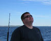 Justin on board. 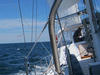 Under sail out of Halifax. Egg Island light. |
||||||||
| Wednesday June 20, 2012 |
Halifax, NS
|
This was the day to go downtown. We took the rental car into Halifax and climbed up to the Citadel, the hugh fortification overlooking the city, the harbor, and the region. The view is spectacular and they have a continuous collection of reenactments of the soldiers activities during heyday of the fort.
We will send a delegation and car to the air port to pick up Justin Harper, who joins up until Baddeck.
|
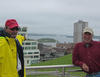 View of Halifax harbor from the Citadel. 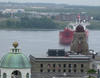 Another view of Halifax harbor from the Citadel. |
||||||||
| Tuesday June 19, 2012 |
Halifax (and vicinity), NS
|
Sean, George, and David struck out this morning to get a rental car and then do some shopping. Since Halifax is the biggest town we will see until we get to St. Johns, NL, in the middle of August, it's an huge oportunity to resupply.
Then off to Peggys Cove, perhaps the most photographed place in Nova Scotia. It has the most famous lighthouse and picturesque fishing village harbor in the region. This early in the season, it's a bit crowded but not overrun and neither George nor David had seen it before. Lunch was at Shaw's Landing in East Dover where we had the best fried clams encountered so far on this trip. Then we stopped the rental car at Prospect which is just across the inlet from Rogues Roost. Prospect harbor is small (not as small as Rogues Roost) and was our fall back position had Rogues Roost been inaccessable.
|
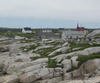 Peggys Cove. 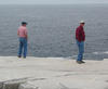 More of Peggy. |
||||||||
| Monday June 18, 2012 |
Halifax, NS
|
Near noon Limmershin tied up at The Royal Nova Scotia Yacht Squadron after an uneventful 20 nm passage.
We slowly made our way out of Rogues Roost about 0800 hrs under cloudy skies and calm, flat conditions. While the skies were gray, the visibility was good (our good fortune with fog continues) and we proceeded out around Pennant Point and into Sambro Channel. Sean was waxing nostalgic about the light air conditions he and his crew on Bingo! encountered trying to claw their way into Halifax harbor for the finish of the 2009 Marblehead to Halifax Ocean Race (they won their class). The Royal Nova Scotia Yacht Squadron is the oldest yacht club in North America so one would think they could be snootier than the Annapolis Yacht Club (meaning they could be very snooty), but that's not so. I have docked Infrared at their wharf four times and been warmly welcomed. Limmershin received the same reception and we will be dockside for a couple of days awaiting a crew arrival. Canada is not an inexpensive place. Mostly, prices are about the same as in the US, but their 15% sales tax jacks up the final purchase price. The most expensive items we require are liquor and fuel, and those things do cost! We paid $6.80 per gallon for diesel here in Halifax (~$3.80 per gal in Baltimore) and the tax on booze is so stiff that the final price difference between the good stuff and the cheap stuff becomes inconsequential since the overwelming portion of the price is tax. For dinner, we ate in the bar at the RNSYS, a convenient spot since we won't get a car until the morning. Good food, a nice atmosphere (regal like a yacht club should be), and no jacket was required. |
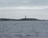 Through the rocky islands to Halifax. 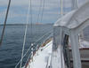 Halifax in sight. 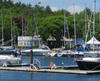 Royal Nova Scotia Yacht Squadron. 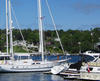 At the RNSYS dock. |
||||||||
| Sunday June 17, 2012 |
Rogues Roost, NS
|
Limmershin departed Lunenburg mid-morning planning to go around the corner into Mahone Bay bound for Chester. There is the Chester Yacht Club but no wharfage other than at the Rope Walk Restaurant so we went there for lunch.
This is probably the most attractive part of the Nova Scotia coast. Mahone Bay is a popular cruising destination for Halifax yachties and Chester Yacht Club is the second only to the Royal Nova Scotia Yacht Squadron. There are many islands and coves for gunk holing. We are still having quite cool mornings that are cloudy but almost completely free of fog, a dramatic contrast to my previous outbound trips when fog was thick and persistant at sea but with warm sunshine once inland. We ended the day by finding Rogues Roost, an anchorage highly recommended in the Cruising Guides. On the way we passed Peggys Cove and Prospect which are candidates for a rental car drive-by once we dock in Halifax. Rogues Roost far exceeded expectations. This is the most scenic anchorage I have ever been in. It is a snug inlet with boulders and scrub trees on shore and deep water (where there weren't rocks) with good holding. We deployed an additional anchor from the stern to keep Limmershin from wandering too close to shore while shifting with wind and tide. 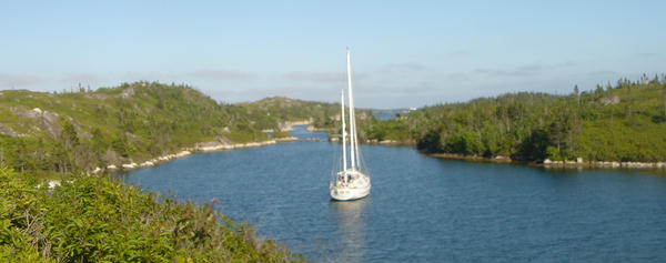 Limmershin in Rogues Roost.
|
 Watering the boat before leaving. 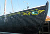 Sailing history. 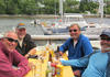 Stopover in Chester. |
||||||||
| Saturday June 16, 2012 |
Lunenburg, NS
|
This is another layover day here in Lunenburg. Mainly to accommodate crew arrival and departure schedules, we have slowed down a bit. That is not a bad thing since we are on schedule, and this is an attractive region to spend some time being a tourist. I have been through Lunenburg on four previous occasions, but this time I have been able to wander farther from the wharf.
The Egret crew, who stopped by last evening, told us how much they enjoyed bicycling to the village of Mahone Bay. They said it was a flat ride of a few miles and the bike rental shop was nearby. Well, none of that was completely accurate but it was enough to get us to strike out for Mahone Bay ourselves. It's hard to go completely wrong on a trip around here, and we did see some cool stuff, but the trip could be described as a long hike, followed by hilly ride half of it to windward, followed by some mountain climbing. The other thing we learned was that one should never let the cooks navigate. Tomorrow we expect to leave for Chester.
|
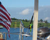 Another bright morning in Lunenburg harbor. 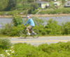 Bike trip from Lunenburg to Mahone Bay. 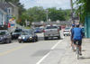 Mahone Bay by bike. |
||||||||
| Friday June 15, 2012 |
Lunenburg, NS
|
This is a layover day here in Lunenburg for two reasons. The forecast for NE 15-25 kt winds (which would be a serious headwind for us) and the arrival of new crew, David Jenkins flying in from Baltimore.
So we cleaned Limmershin's decks and salon, did some laundry, and went to lunch. On the way through town, we were tourists and there are some great sights here. After lunch, it was a resupply trip to the grocery store and a long trek to the (government run and, therefore, very distant) liquor store. Upon arrival yesterday, we noticed Egret, a Bristol 41 also from Oxford, MD. So we invited ourselves onboard for a few drinks and reciprocated, inviting them to stop by Limmershin today.
|
 Needed to get around town.  Whaling in Lunenburg?!! |
||||||||
| Thursday June 14, 2012 |
Lunenburg, NS
|
Leaving Liverpool/Brooklyn, Limmershin was under way at 0615 on the way to Lunenburg. The most fog we have seen so far was lurking outside the headlands, but it wasn't that bad and lifted by the time we motored into Lunenburg Bay.
One of the most interesting towns in maritime Canada, Lunenburg looks the part of a once thriving shipbuilding and fishing port, and it seems to still be working at these trades. The level of activity in the shipyards was the most I had seen in previous (2002 and 2004) visits. Limmershin found a floating dock on the wharf at Scotia Trawler, one of the working shipyards. We arrived just before noon, in time for fried clams at The Dock Side Restaurant. A forecast for headwinds tomorrow suggested a layover day before we strike out for Halifax or Mahone Bay on Saturday.
|
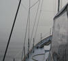 Finally, some fog. 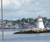 Into Lunenburg harbor. |
||||||||
| Wednesday June 13, 2012 |
Liverpool/Brooklyn, NS
|
Limmershin left Shelburne at 0945 this morning for the ~50 nm run along the coast to Liverpool. The Morse brothers stayed behind to catch a shuttle to the Halifax airport, going home. So the crew is down to Sean, George, and Bob for a while.
The famed Nova Scotia fog had been absent until this morning when we awoke to overcast, cool conditions. However, when we exited the headlands, the fog was nowhere near as opaque as it can be, and it gradually lifted as we motor-sailed in light air toward Liverpool. The destination is Liverpool, but the available wharfage is in Brooklyn, a couple of miles from Liverpool. By the time one gets to Liverpool, the waterfront is constricted to the banks of the Mersey River (get it?...Ferry Across the Mersey (1965)?), so sailboats go to Brooklyn. This region is proud of its history of privateering during the era of the American Revolution, so we visited the park memorializing it and had a beer at Lane's Privateer Inn to get in the swing of things. Tomorrow we hope to reach Lunenburg and may be encouraged to layover because of forecast headwinds. |
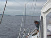 Out of Shelburne. 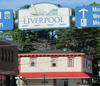 Liverpool tour sight.  Near the Mersey River. |
||||||||
| Tuesday June 12, 2012 |
Shelburne, NS
|
With the late arrival last night, we decided a layover was in order. So we moved Limmershin to the Shelburne Harbor Yacht Club marina (which we couldn't find in the dark last night) and set about cleaning, repair and maintanence chores this morning.
Later in the day, the SHYC was having a 2 for 1 Happy Hour so we, of course, participated. The Morse brothers leave the boat tomorrow, so Sean, George, and Bob will make for Liverpool tomorrow.
|
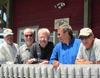 A crew gathering at SHYC. 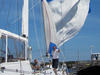 Drying a wet spinnaker at the dock. |
||||||||
| Monday June 11, 2012 |
Shelburne, Nova Scotia
|
The overnight sail from Provincetown, MA, to Shelburne, NS, was completed in the gentlest weather imaginable for the North Altantic. Wind and waves were calm and there was only the slightest ocean swell (remarkable since the fetch reaches some 8000 nm to Africa!).
With clear skies and a waxing quarter phase moon, it was as dark as can be. That provided a spectacular view of the start. Stars were shining brightly all the way down to the horizon, but the view of the sea over Limmershin's bow was pure blackness. Very little other marine traffic was sighted but what did come into view was most interesting. George and Bob (the first watch) caught a VHF radio communication between the US Navy and the Coast Guard regarding a close passing of a USCG vessel with a disabled fishing boat boat in tow and a ship indentifying itself as the "CVN something or other". At the change of watch, skipper Sean Calahan, USN (Ret.) informed us that (much to our surprise) CVN identifies a nuclear aircraft carrier! George thought he did hear the words "aircraft carrier" in the radio call and subsequent voice and visible aviation traffic seemed to confirm this. Limmershin's radar showed a closest approach of the carrier of 7 nm, the second watch (Sean, Dick, and Peter) followed the running lights for some time. Now, a really interesting part of the encounter was our radar detection of what could have been a submarine. A transient echo consistent with a periscope target and another later larger return consistent with a conning tower certainly made us wonder. Were those evil Ruskies up to some Cold War mischief? George and Bob were frantically trying to call Tom Clancy on the satellite phone when Sean pointed out that carriers always have a submarine escort. If that wasn't enough excitment, there was the shark attack. At about 0730, a sizable dorsal fin was observed about 25 yards off the port beam approaching Limmershin. The fish continued on, impacting the boat just aft of the bow. The fish seemed stunned and was last seem in the wake probably headed for the shark dentist since Limmershin is a concrete boat. And if all that wasn't enough excitement, there is the rescue at sea Limmershin performed! Approaching Brazil Rock just east of Cape Sable off Nova Scotia's southwestern shore, we saw a large sailboat actually under sail. Remarkable since there was no wind. We had been hearing some Coast Guard radio traffic that suggested someone trying to arrange a tow for a disabled boat, and we were soon hailed (we were the only vessel in sight, and you could see a long way). Being red-blooded American boys, we went to the rescue. Passing a tow line to sailing vessel, G'Tana, a 71 foot Frers out of Newport with an inoperative engine, we pulled them close to 40 nm into Shelburne harbor. A power boat from the yacht club then maneuvered them to the Government wharf and we tied up there, too. It would be a better story if I could report on the raging gale, driving sleet, and deadly high seas, but it was flat and calm and the tow went smoothly. Finally the crossing of the Gulf of Maine ended at midnight. |
 Canadian sunrise. 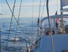 Doesn't get much easier. 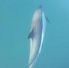 Canadian escort service. 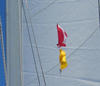 Flag raising for foreign port landing. 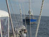 Rescue at sea. 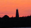 Sunset over Cape Roseway. 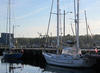 After tow, at the Shelbourne wharf. 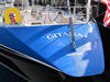 G'Tana is rescued. |
||||||||
| Sunday June 10, 2012 |
Leaving Provincetown, MA
|
Limmershin began the Gulf of Maine crossing at 0500 this morning. We expect an uneventful overnight passage since there is nothing in the forecast of concern. It's about 240 nm and we are bound for Shelbourne, Nova Scotia, expecting to arrive by 1800 hours Monday.
More about our Provincetown visit and some pictures when we again have signal for internet access. |
Pictures coming later!
|
||||||||
| Saturday June 9, 2012 |
Buzzards Bay
|
Dropped the mooring in Newport at dawn heading up Buzzards Bay, through the Cape Cod Canal and on to Provincetown at the tip of Cape Cod. It's important to time one's arrival at the canal to assure a favorable current. That's why we left Newport so early, we needed to be at the canal at 1100 hrs.
After the canal, it's across Cape Cod to Provincetown at the far end of the cape. We arrived around 1600 hrs and took a slip at the only marina in town (read "expensive"). Then, off to find batteries, bagels, and bread. Provincetown has a reputation for eccentricity in many different ways and, especially on a Saturday evening, it did not disappoint. The street scene was lively and colorful, to say the least. We have been making good time since the weather has been so favorable. Today we had light air and flat water the whole way. In a motorsailer like Limmershin this is not so bad, but some sail time down the road is hoped for.
|
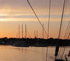 An early start out of Newport! 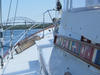 Through the Cape Cod Canal. 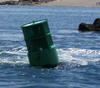 A river runs through it. |
||||||||
| Friday June 8, 2012 |
Newport, RI
|
Brent returned this morning for final tweaking and we were moving out of the harbor shortly after 1000 hrs. Since we had to go into Montauk, Block Island lost out as a stop over and we headed for Newport.
Light air to begin with, but sunny and cool made for a nice motor-sail. By the time we past Point Judith, the breeze had picked up so our arrival into Narragansett Bay was most picturesque. Into Newport harbor, passing Fort Adams, and working one's way through the mooring field reminds even the casual observer that this is truly the yachting center of the East Coast. George pointed out that Newport is one of a very few places where Limmershin is not a big sailboat. Into town, we made the traditional visit to the Black Pearl for a Dark & Stormy (the Navigator had two) and then, also a tradition, dinner at the Red Parrot. The tourist season is still a few weeks away, but all the shops, restaurants, and bars are open but not crowded. This is a great time to be here from that perspective. Not a late night on the town since departure for Provincetown is at dawn tomorrow. Except for a day lost in Cape May to headwind, the weather has been very cooperative and appears to want to continue that way at least as far an Shelbourne in Nova Scotia.
|
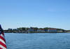 Montauk in the rear view mirror.
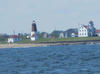 Point Judith, on the way into Narragansett Bay.
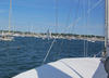 Arriving in Newport.
|
||||||||
| Thursday June 7, 2012 |
Montauk, NY
|
We knew there would be adventures on this trip and the first big one happened today.
Departing Utsch's Marina in Cape May at dawn on Wednesday, we motor-sailed in pleasant conditions at 7.5-8 knots at 060 degrees toward Block Island. We were making good time until, near 0800 Thursday morning, Limmershin lost propulsion. The transmission had failed. That being a problem too big to fix onboard, we considered other options. Since Limmershin is a sail boat, using wind power to get to the Newport Shipyard seemed like a good idea. But one needs wind stronger than 2 knots to arrive by the end of the month. Since Bob carries unlimited towing on his Boat/US account, we arranged to be schleped into Montauk (at the far end of Long Island) where we had been assured they have the capability and willingness to attack the problem promptly. It's a good thing it's Bob with the insurance, since the Eastern Shore sailors would never consent to being towed anywhere! Tow Boat/US boys arrived out of the fog (which rolled in shortly after we were disabled) just before noon, hooked us up and headed for Montauk. Being towed is not a proud experience for any sailor, but bobbing at sea for hours (days?) is less attractive. We were headed for Montauk Marine Basin for repair. But, all luck isn't bad luck! When the mechanic looked at the trouble, he saw that the transmision coupling was displaced and set about replacing the sheared bolts on that coupling. How they got that way is an open question, but it was gratifying to hear that the transmission was fine and the repair straight forward, thanks to Brent from the Montauk Boat Basin staff of mechanical geniuses. So, what seemed to be a major setback turned out to be not so bad. At the end of the day we are pleasantly docked in Montauk, having eaten dinner swapping stories over an overpriced dinner (who knew this is the eastern end of the Hamptons?), so what looked bad at the start worked out fine.
|
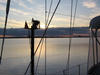 Going out to sea at dawn. 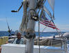 Motor-sailing with sunshine and light wind out of Cape May. 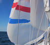 Spinnaker up! 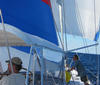 Mizzen staysail, too. 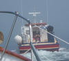 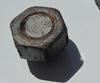 The bolts that failed! |
||||||||
| Tuesday June 5, 2012 |
Cape May, NJ
|
We chose to lay over today upon hearing a forecast for NE winds 15-25 knots with 6 to 9 foot seas on our route to Block Island. That would have made for a slow, wet, bumpy slog to windward and since "Gentlemen don't sail to windward!", we stayed in port.
It turned out to be a good decision. Today has indeed shown strong NE wind, but the sunshine made it a good day to visit the town and see the beach. Sean and Dick cleared an obstruction in the boat's hot water system, so the day was productive. We plan to leave early in the morning. It will take us 30 to 33 hours to make it to Block Island, so it will be an overnight sail. The weather ought to be benign with light and variable wind and 3 to 5 foot seas. |
 George in his place in Cape May!
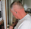 There's always something to fix on a boat.
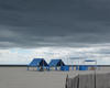 Plenty of sun, but too cool and breezy for the beach crowd.
|
||||||||
| Monday June 4, 2012 |
Cape May, NJ
|
Underway yesterday (Sunday) shortly after 0500 hrs, we caught the eastbound current in the C&D Canal which moved Limmershin along at 8.5-9 knots. As we turned south in the upper Delaware Bay, the wind picked up , blowing from the north (on our stern) at 15 to 25 knots. Sunshine and clouds, cool temperatures made for a pleasant sail.
Since Limmershin is too tall for the bridges over the Cape May Canal, we had to round the actual lands end. We happened to be there at slack tide so it was nowhere near as exciting as it can be to navigate the inshore passage, which is right off the beach. Dodging an impressive thunderstorm complex, we made our way into Utsch's Marina (Infrared's usual stop over) being pleased to find that there was plenty of water. The dock master explained that the tugs used to dredge the Coast Guard station wharf came in for fuel and their huge prop wash cleared a a foot and a half of sand off the bottom. Coastal flood warnings had been issued for Cape May and while eating at the Lobster House, we watched the tide rise to the point that the lobby, front bar, and parts of the kitchen had ankle deep water in them as we left. It's a bit puzzling since there was only a weak onshore breeze and not enough rain to make a difference, so the flooding was caused only by the high tide. |
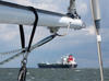 Sun, wind, and waves on the Delaware Bay going to Cape May.
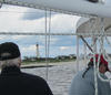 Around Cape May.
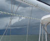 Going into Cape May.
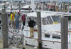 At Utsch's Marina, Cape May, NJ.
|
||||||||
| Sunday June 3, 2012 |
Bohemia River, MD
|
We left Oxford on time this morning. Weather was great and we motor sailed up the bay arriving for a overnight layover at anchor in the Bohemia River. A late afternoon squall gave us some wind and brief, heavy rain just before anchoring. |
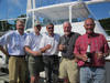 We are actually going!
|
||||||||
| Saturday Evening June 2, 2012 |
Oxford, MD
|
Limmershin is stocked, watered, fueled, and (except for ice) ready to leave around 1000 hrs tomorrow. |
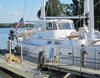 Let's get going! |
||||||||
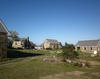
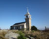
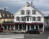
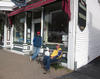
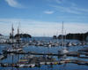

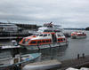
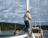
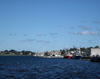
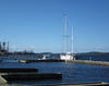
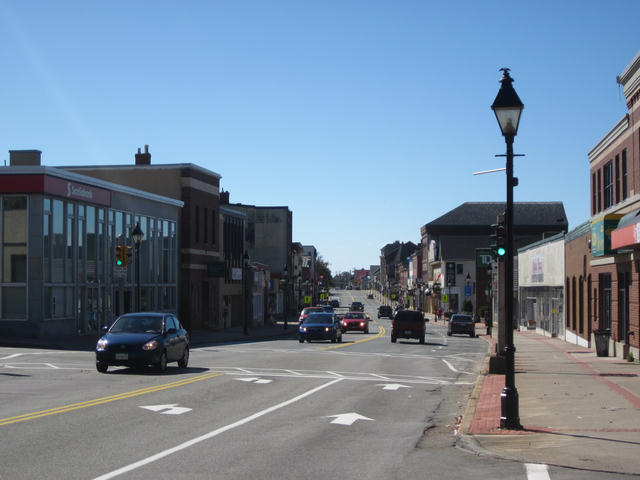
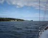
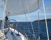
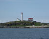
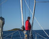
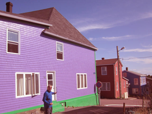
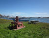
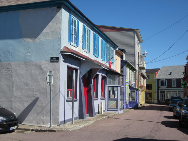
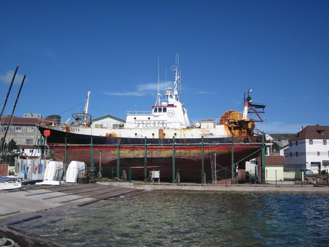
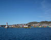
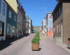
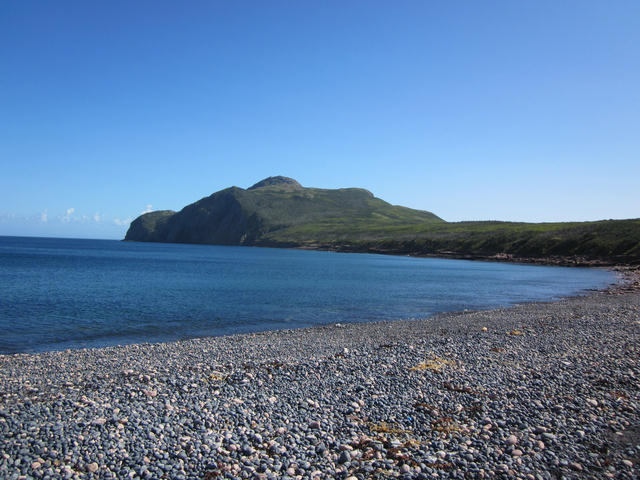
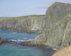
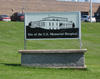
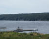
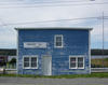
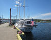


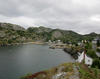
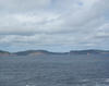

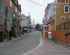


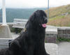
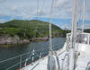
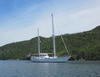
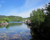
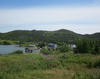
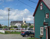
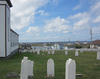
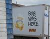
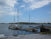
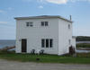
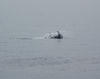
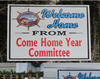
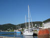
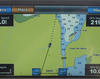
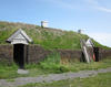
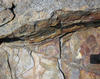

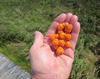
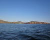
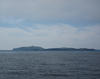
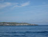


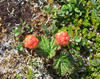
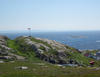
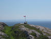
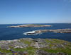
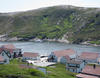
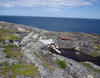
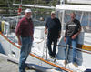
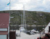
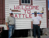
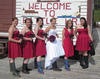
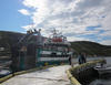
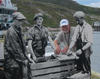
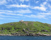
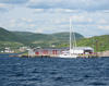


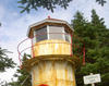
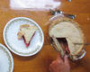
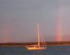
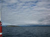
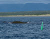
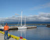
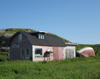
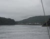
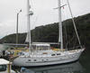
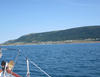
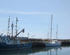
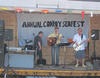
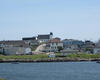
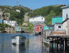
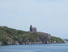
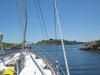
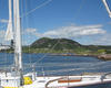
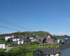
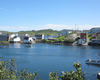
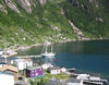 Limmershin at her final dock in Francois.
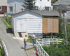
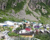
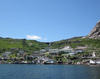
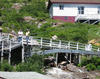

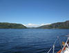
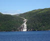

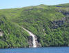
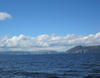
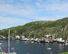
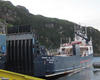

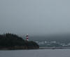
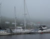
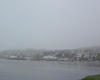

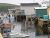
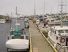
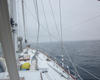
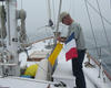
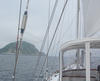
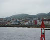


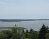
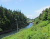
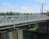
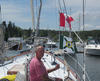
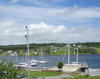
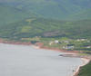
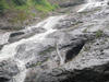
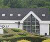
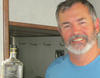

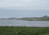
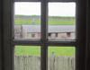
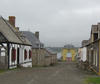
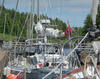
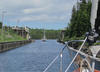

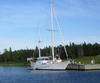
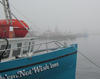
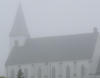

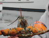


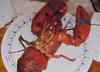

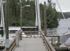
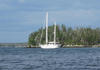
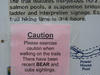
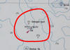

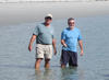
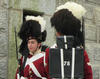
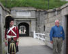
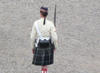
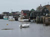
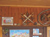

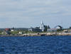
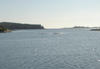
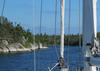
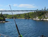
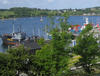


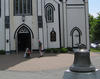
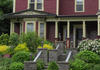
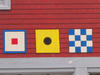
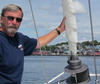

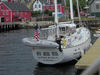
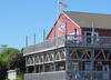
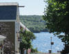
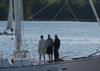
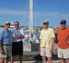


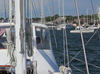
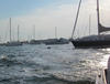
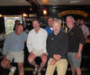
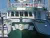
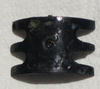
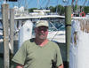

This page has been accessed
times since its posting on April 7, 2012.